MyTopo
Hallsville Missouri US Topo Map
Couldn't load pickup availability
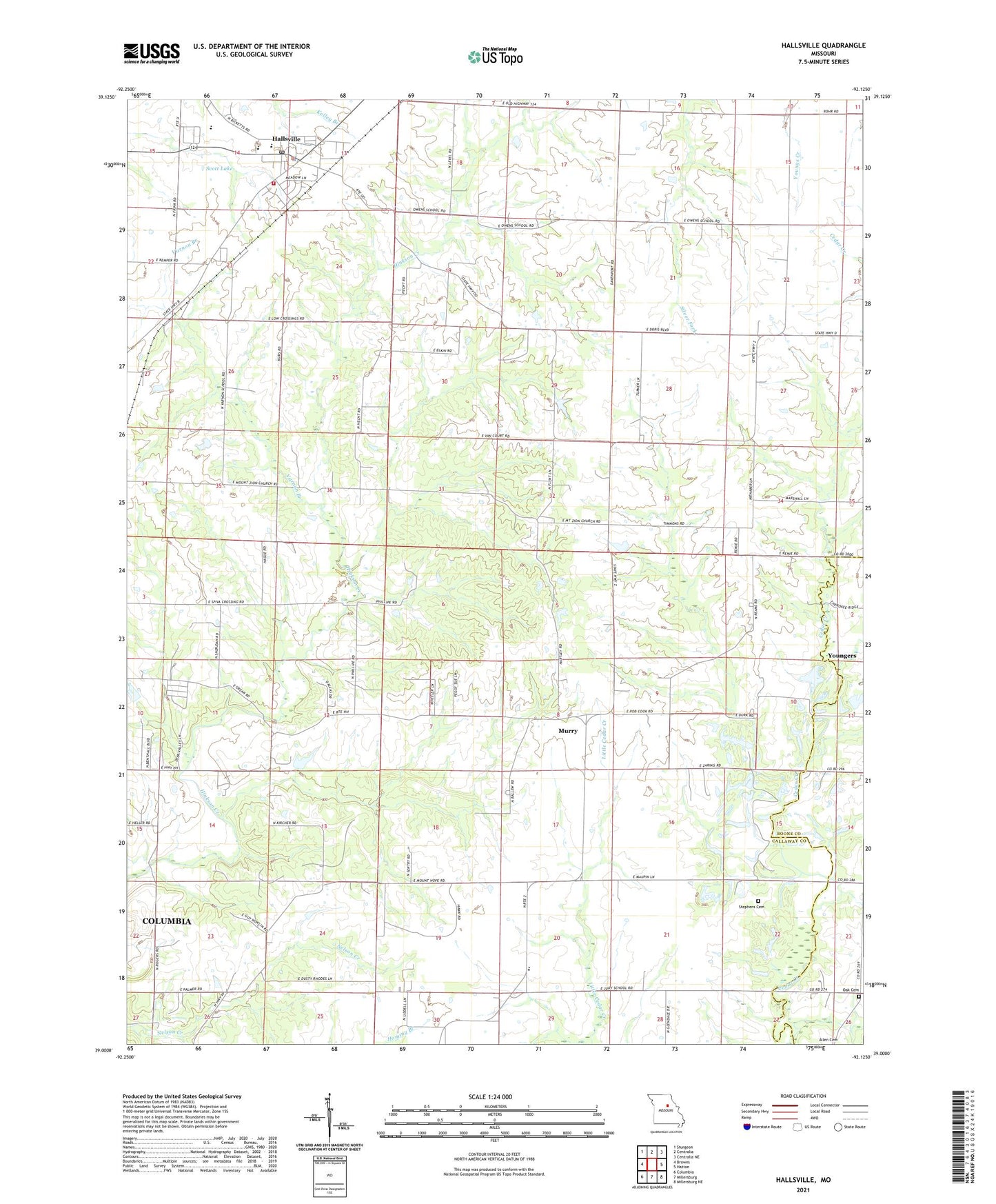
2021 topographic map quadrangle Hallsville in the state of Missouri. Scale: 1:24000. Based on the newly updated USGS 7.5' US Topo map series, this map is in the following counties: Boone, Callaway. The map contains contour data, water features, and other items you are used to seeing on USGS maps, but also has updated roads and other features. This is the next generation of topographic maps. Printed on high-quality waterproof paper with UV fade-resistant inks.
Quads adjacent to this one:
West: Browns
Northwest: Sturgeon
North: Centralia
Northeast: Centralia NE
East: Hatton
Southeast: Millersburg NE
South: Millersburg
Southwest: Columbia
Contains the following named places: Andy Lake, Andy Lake Dam, Boone County Fire Protection District Station 3, City of Hallsville, Cumminghams Lake Dam, Grand View School, Grandview Church, Hallsville, Hallsville High School, Hallsville Intermediate School, Hallsville Middle School, Hallsville Police Department, Hallsville Post Office, Hallsville Primary School, Hardin Field, Jones School, Judy School, Lebanon, Linn Lake Dam, Mount Hope Church, Mount Zion Church, Murry, Murry School, New Red Top Church, Oak Cemetery, Oak Chapel, Old Red Top Church, O'Rear School, Owen School, Points, Potts School, Renfro Creek, Scott Lake, Scott Lake Dam, Stephens Cemetery, Township of Rocky Fork, Two Mile Prairie, Two Mile Prairie Elementary School, Varnon Branch, Varnon School, Wasley Lake Dam, ZIP Code: 65255