MyTopo
Sturgeon Missouri US Topo Map
Couldn't load pickup availability
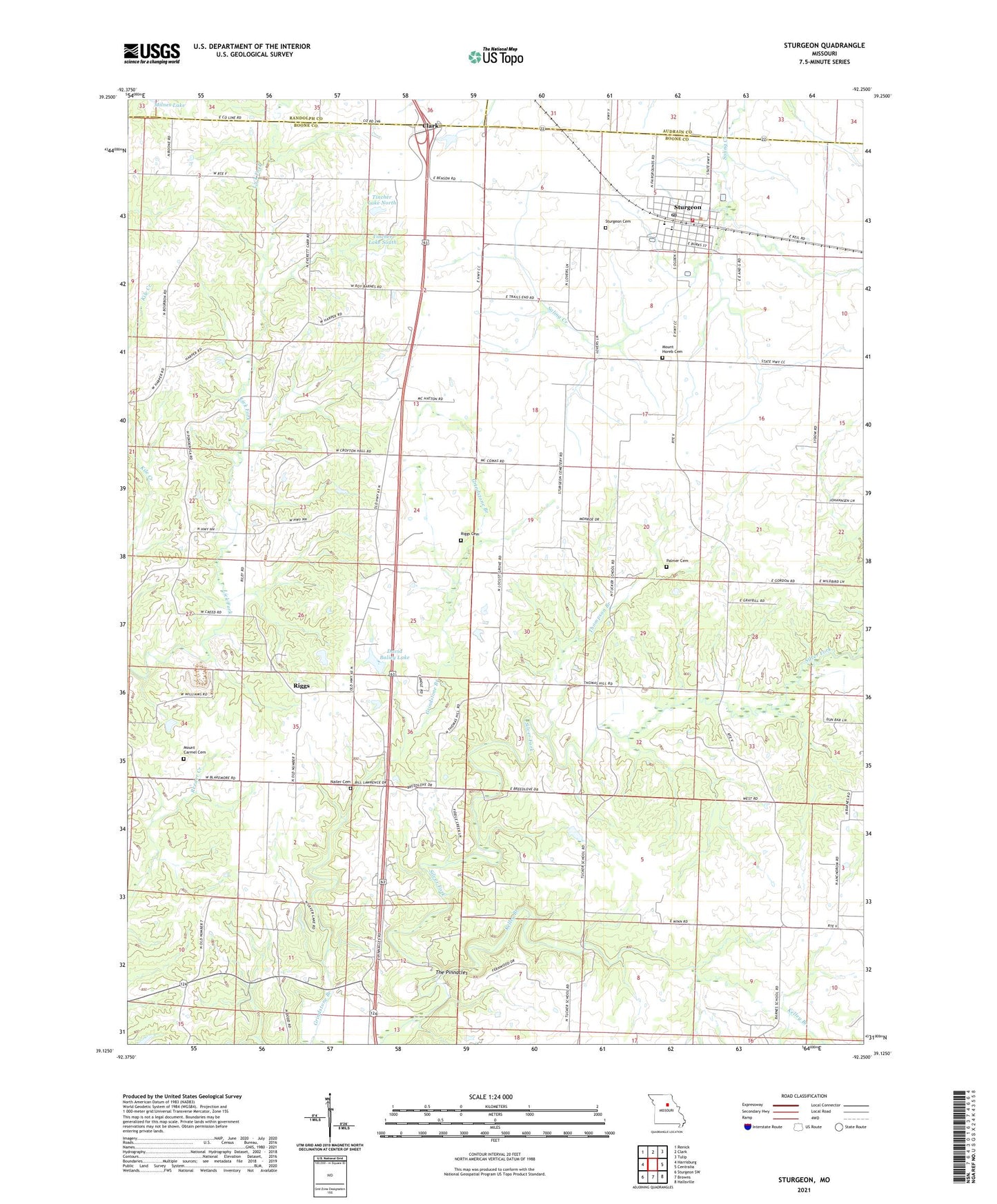
2021 topographic map quadrangle Sturgeon in the state of Missouri. Scale: 1:24000. Based on the newly updated USGS 7.5' US Topo map series, this map is in the following counties: Boone, Audrain, Randolph. The map contains contour data, water features, and other items you are used to seeing on USGS maps, but also has updated roads and other features. This is the next generation of topographic maps. Printed on high-quality waterproof paper with UV fade-resistant inks.
Quads adjacent to this one:
West: Harrisburg
Northwest: Renick
North: Clark
Northeast: Tulip
East: Centralia
Southeast: Hallsville
South: Browns
Southwest: Sturgeon SW
This map covers the same area as the classic USGS quad with code o39092b3.
Contains the following named places: Angel Lake Dam, Bailey Lake Dam, Baumgarner Brothers Lake, Boone County Fire Protection District Station 6, Bourbon, Bumgarner Lake Section 11 Dam, Bumgarner Lake Section 3 Dam, City of Sturgeon, Country Box Estates Lake Dam, David Baliey Lake, Flint School, Grindstone Branch, Hawk Air Airport, Kelley Branch, Locust Grove Church, Mount Carmel Cemetery, Mount Horeb Cemetery, Nailer Cemetery, North 40 Lake Dam, Palmer Cemetery, Petersburg, Pollock Lake Dam, Riggs, Riggs Cemetery, Salmons Lake Dam, Sturgeon, Sturgeon Cemetery, Sturgeon Elementary School, Sturgeon High School, Sturgeon Middle School, Sturgeon Post Office, The Pinnacles, Thompson Branch, Tincher Lake North, Tincher Lake North Dam, Tincher Lake South, Tincher Lake South Dam, Township of Bourbon, Tucker School, Turner School, Wayland Lake Dam, Winn School, Woods School, ZIP Code: 65284