MyTopo
Browns Missouri US Topo Map
Couldn't load pickup availability
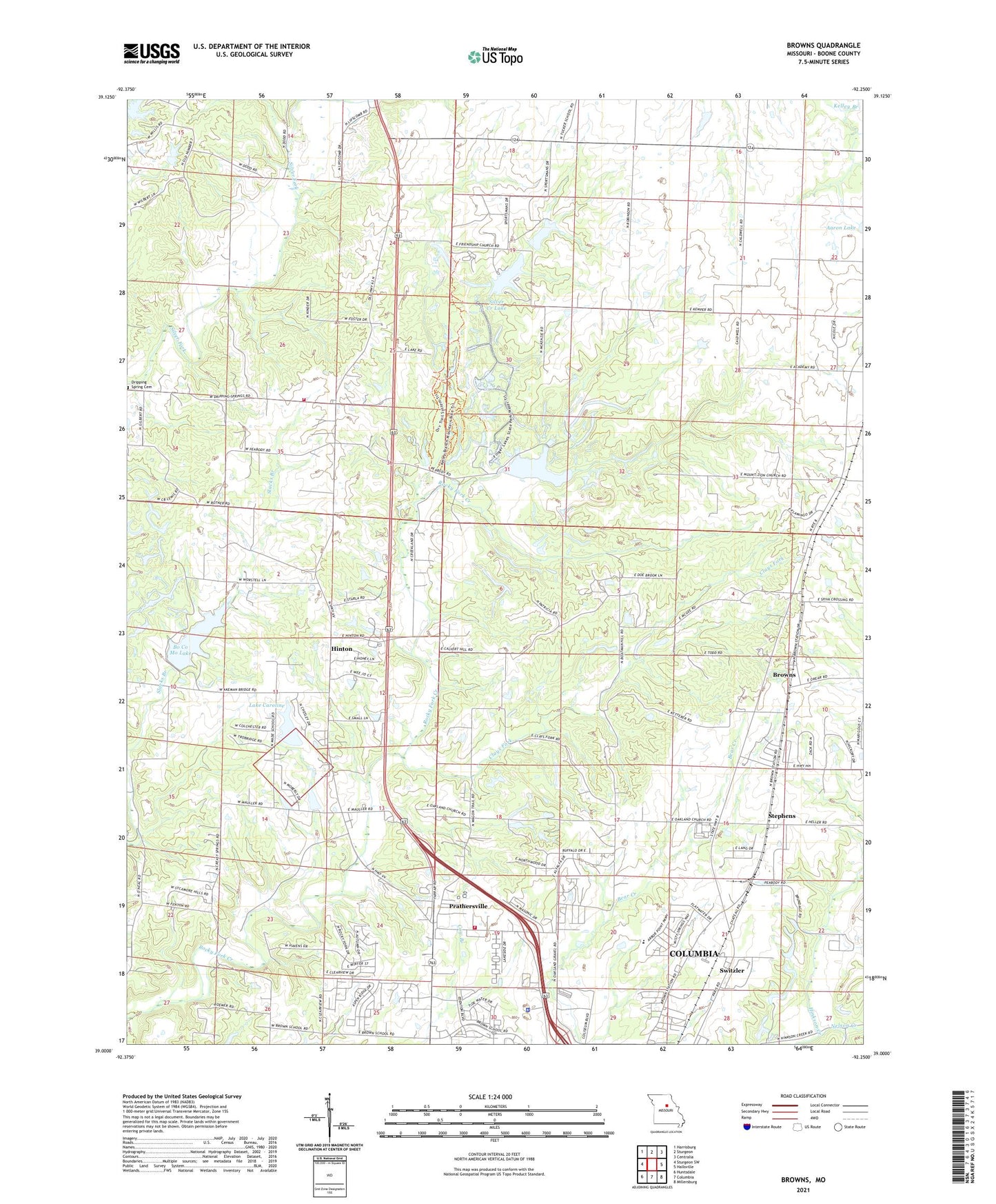
2021 topographic map quadrangle Browns in the state of Missouri. Scale: 1:24000. Based on the newly updated USGS 7.5' US Topo map series, this map is in the following counties: Boone. The map contains contour data, water features, and other items you are used to seeing on USGS maps, but also has updated roads and other features. This is the next generation of topographic maps. Printed on high-quality waterproof paper with UV fade-resistant inks.
Quads adjacent to this one:
West: Sturgeon SW
Northwest: Harrisburg
North: Sturgeon
Northeast: Centralia
East: Hallsville
Southeast: Millersburg
South: Columbia
Southwest: Huntsdale
This map covers the same area as the classic USGS quad with code o39092a3.
Contains the following named places: Aaron Lake, Aaron Lake Dam, Alpha Hart Lewis Elementary School, Ausburns Lake Dam, Barnes School, Bo Co Mo Lake, Boco Mo Dam, Bon-Gor Lake Dam, Boone County Fire Protection District Station 5, Boone County Fire Protection District Station 7, Boone County Sheriff's Office, Browns, Browns School, Camp Takimina, Clays Fork, Columbia Sportsmans Club Lake Dam, Conley School, Country View Acres Lake Dam, County Downes Lake Dam, Dripping Spring, E W Cotton Woods Memorial Airport, Finger Lakes State Park, Friendship Church, Garrett Lake Dam, Hinton, Hopper Dam, Lake Caroline, Lewis Lake Dam South, McKenzie Lake Dam, Middleton, Middletown School, Nelson Creek, Prathersville, Rayfield Lake Dam, Rocky Fork Creek Dam, Rocky Fork Lakes Conservation Area, Searcy School, Seltsam Lake Dam, Silver Creek Lake, Silver Creek Lake Dam, Stephens, Switzler, Turner School, Wade School, Walnut Crest Lake Dam, Weil Lake Dam, ZIP Code: 65202