MyTopo
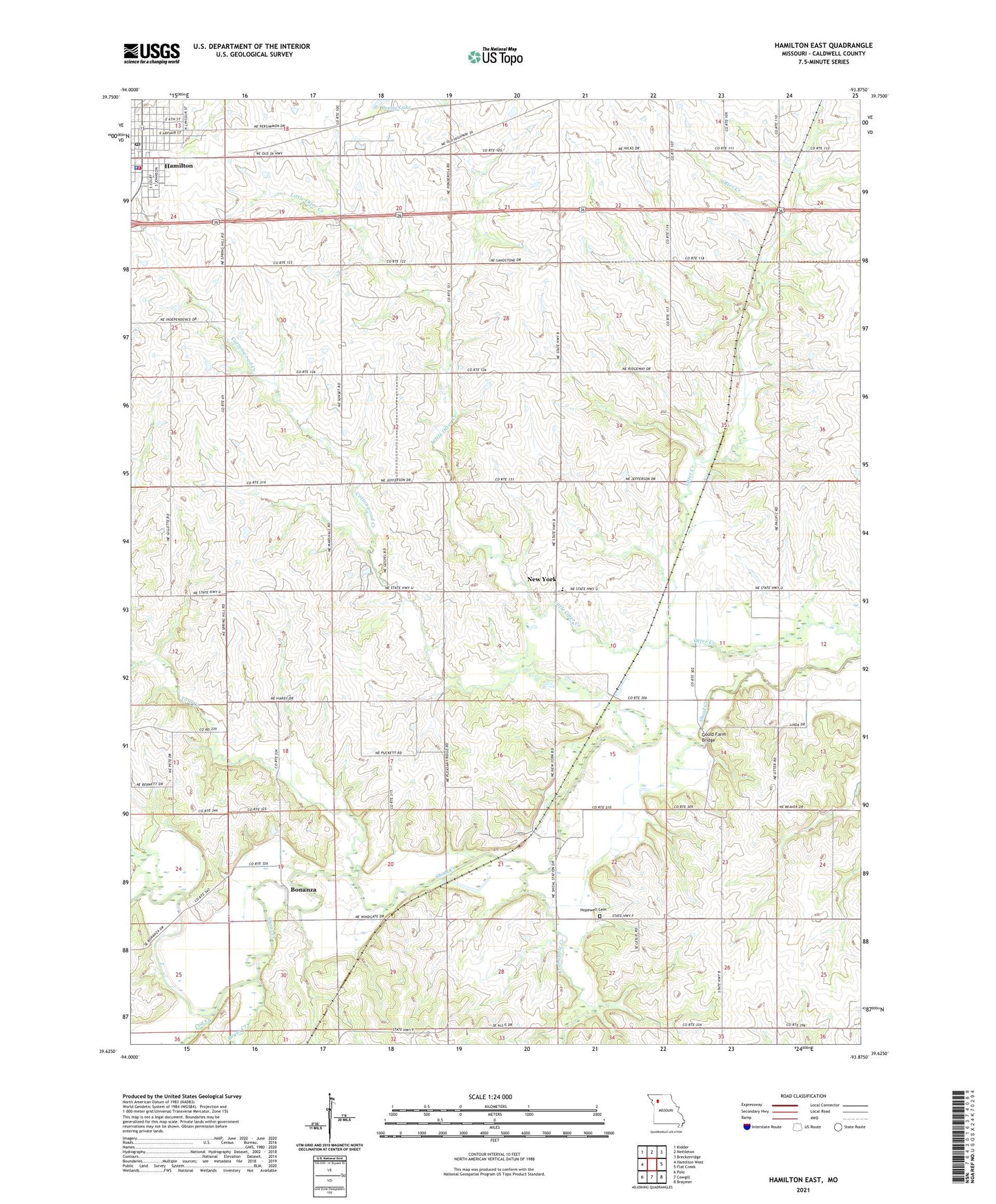
Hamilton East Missouri US Topo Map
Couldn't load pickup availability
2021 topographic map quadrangle Hamilton East in the state of Missouri. Scale: 1:24000. Based on the newly updated USGS 7.5' US Topo map series, this map is in the following counties: Caldwell. The map contains contour data, water features, and other items you are used to seeing on USGS maps, but also has updated roads and other features. This is the next generation of topographic maps. Printed on high-quality waterproof paper with UV fade-resistant inks.
Quads adjacent to this one:
West: Hamilton West
Northwest: Kidder
North: Nettleton
Northeast: Breckenridge
East: Flat Creek
Southeast: Braymer
South: Cowgill
Southwest: Polo
Contains the following named places: Baker Hill School, Bonanza, Bonanza School, Brown Jug School, Brush Creek, Caldwell County, Cliff Scott Airport, Cottonwood Creek, Crabapple Creek, Easterville, Easterville School, Excelsior School, Gould Farm, Gould Farm Bridge, Hamilton, Hamilton Accelerated Elementary School, Hamilton Fire Department, Hamilton Post Office, Hopewell Cemetery, Hopewell Church, Liberty Bell School, Liberty Eagle School, Little Otter Creek, Log Creek, New York, New York Elementary School, Pleasant Ridge School, Radical School, Shoal, Spring Hill School, Spring Valley School, Tom Creek, Township of Gomer, Township of New York, Van Note School, ZIP Code: 64644