MyTopo
Breckenridge Missouri US Topo Map
Couldn't load pickup availability
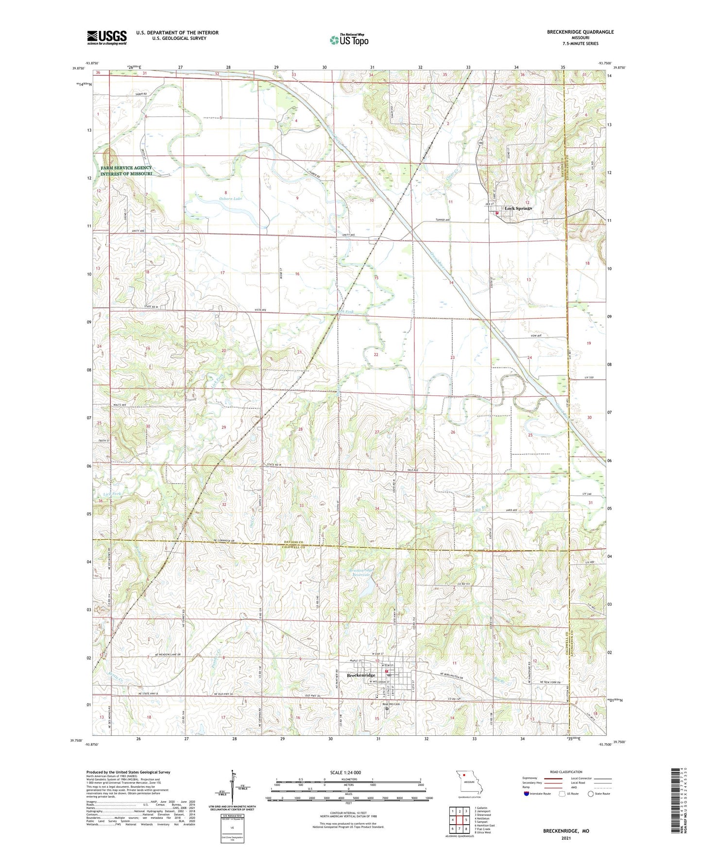
2021 topographic map quadrangle Breckenridge in the state of Missouri. Scale: 1:24000. Based on the newly updated USGS 7.5' US Topo map series, this map is in the following counties: Daviess, Caldwell, Livingston. The map contains contour data, water features, and other items you are used to seeing on USGS maps, but also has updated roads and other features. This is the next generation of topographic maps. Printed on high-quality waterproof paper with UV fade-resistant inks.
Quads adjacent to this one:
West: Nettleton
Northwest: Gallatin
North: Jamesport
Northeast: Shearwood
East: Sampsel
Southeast: Utica West
South: Flat Creek
Southwest: Hamilton East
This map covers the same area as the classic USGS quad with code o39093g7.
Contains the following named places: Big Branch, Breckenridge, Breckenridge Elementary School, Breckenridge High School, Breckenridge Post Office, Breckenridge Reservoir, Breckenridge Volunteer Fire Department, City of Breckenridge, City of Breckenridge Dam, Clear Creek, Elm Grove School, Hale School, Highland Church, Kettle Creek, Lick Fork, Lock Springs, Lock Springs Fire Department, Mann School, Muddy Creek, Osborn Lake, Owl Creek, Packwood Lake, Railroad School, Reed School, Rose Hill Cemetery, South Lake, Township of Harrison, Trotter School, Village of Lock Springs, ZIP Code: 64654