MyTopo
Kidder Missouri US Topo Map
Couldn't load pickup availability
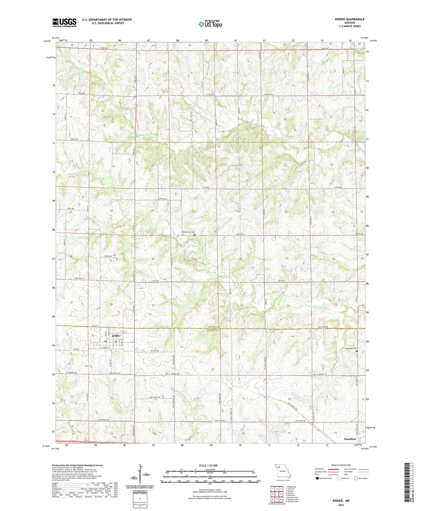
2021 topographic map quadrangle Kidder in the state of Missouri. Scale: 1:24000. Based on the newly updated USGS 7.5' US Topo map series, this map is in the following counties: Daviess, Caldwell. The map contains contour data, water features, and other items you are used to seeing on USGS maps, but also has updated roads and other features. This is the next generation of topographic maps. Printed on high-quality waterproof paper with UV fade-resistant inks.
Quads adjacent to this one:
West: Winston
Northwest: Weatherby
North: Altamont
Northeast: Gallatin
East: Nettleton
Southeast: Hamilton East
South: Hamilton West
Southwest: Cameron East
This map covers the same area as the classic USGS quad with code o39094g1.
Contains the following named places: Advance School, Allen School, Bowman Cemetery, Castor School, City of Kidder, Hopkins School, Kidder, Kidder - Altamont - Winston Volunteer Fire Protection District Station 2, Kidder Post Office, Lone Star School, Lovely Ridge School, Madison School, Number 534 Dam, Selle School, Swisher School, Township of Sheridan, Wesley Chapel, Wooderson Cemetery, Wooderson School, ZIP Code: 64649