MyTopo
Handy Missouri US Topo Map
Couldn't load pickup availability
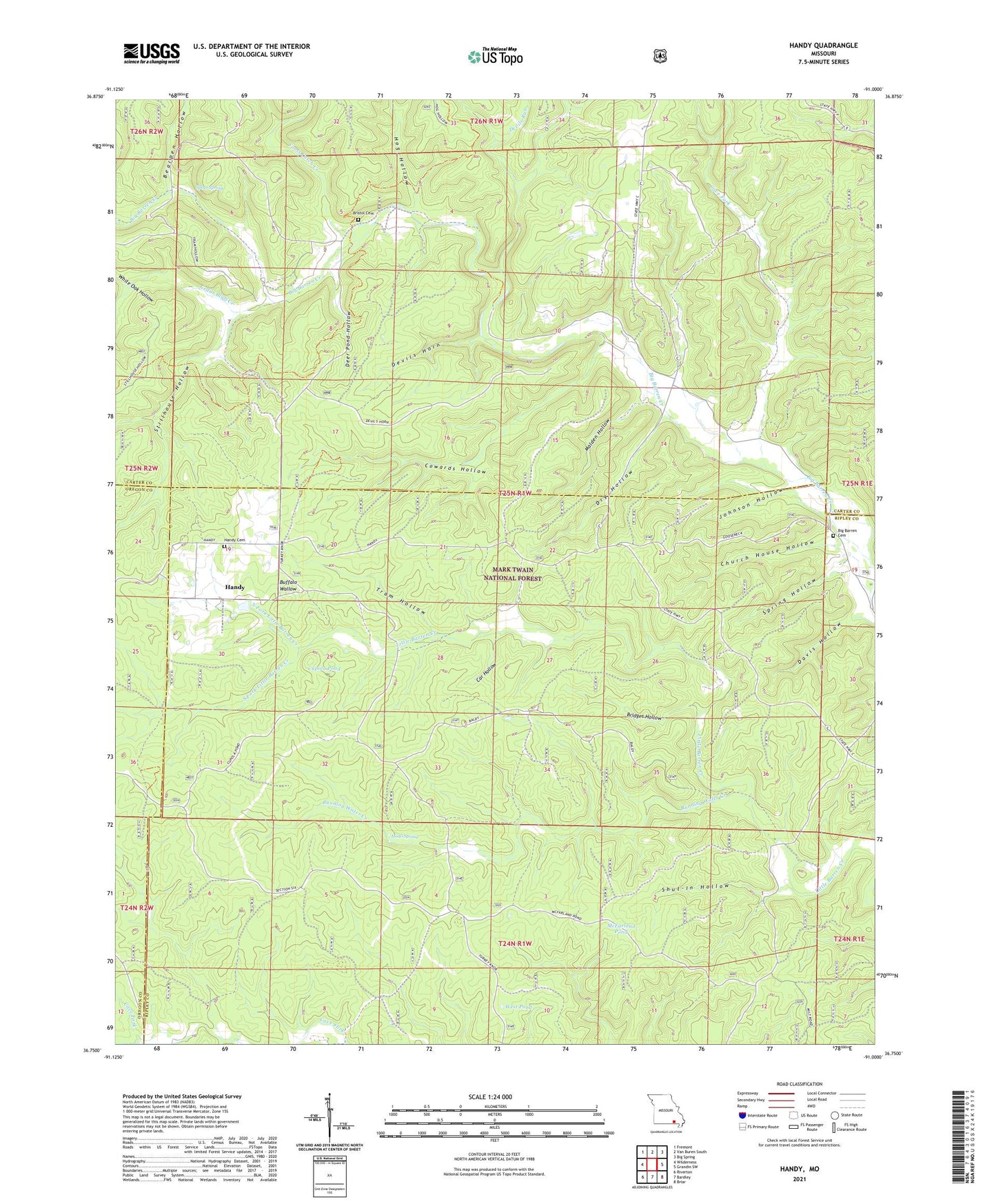
2021 topographic map quadrangle Handy in the state of Missouri. Scale: 1:24000. Based on the newly updated USGS 7.5' US Topo map series, this map is in the following counties: Ripley, Carter, Oregon. The map contains contour data, water features, and other items you are used to seeing on USGS maps, but also has updated roads and other features. This is the next generation of topographic maps. Printed on high-quality waterproof paper with UV fade-resistant inks.
Quads adjacent to this one:
West: Wilderness
Northwest: Fremont
North: Van Buren South
Northeast: Big Spring
East: Grandin SW
Southeast: Briar
South: Bardley
Southwest: Riverton
Contains the following named places: Baldy Lookout Tower, Barren, Bearpen Hollow, Big Barren Church, Bridges Hollow, Bristol Cemetery, Bristoll School, Buffalo Wallow, Car Hollow, Cave Fork, Cedar Bluff Creek, Church House Hollow, Cowards Hollow, Cupola Pond, Davis Hollow, Deer Pond Hollow, Devils Horn, Devils Run, Dry Hollow, Flat Pond, Fools Catch Creek, Handy, Handy Church, Handy School, Hickory Grove School, Hodo Camp, Hodo Spring, Hog Hollow, Johnson Hollow, Malden Hollow, McFarland Pond, North Fork Little Barren Creek, Oak Grove West School, Running Water Creek, Running Water School, Shut-In Hollow, South Fork Little Barren Creek, Spout Spring, Spring Hollow, Stillhouse Hollow, Sunken Farm, Tram Hollow, West Pond, White Oak Hollow