MyTopo
Harris Missouri US Topo Map
Couldn't load pickup availability
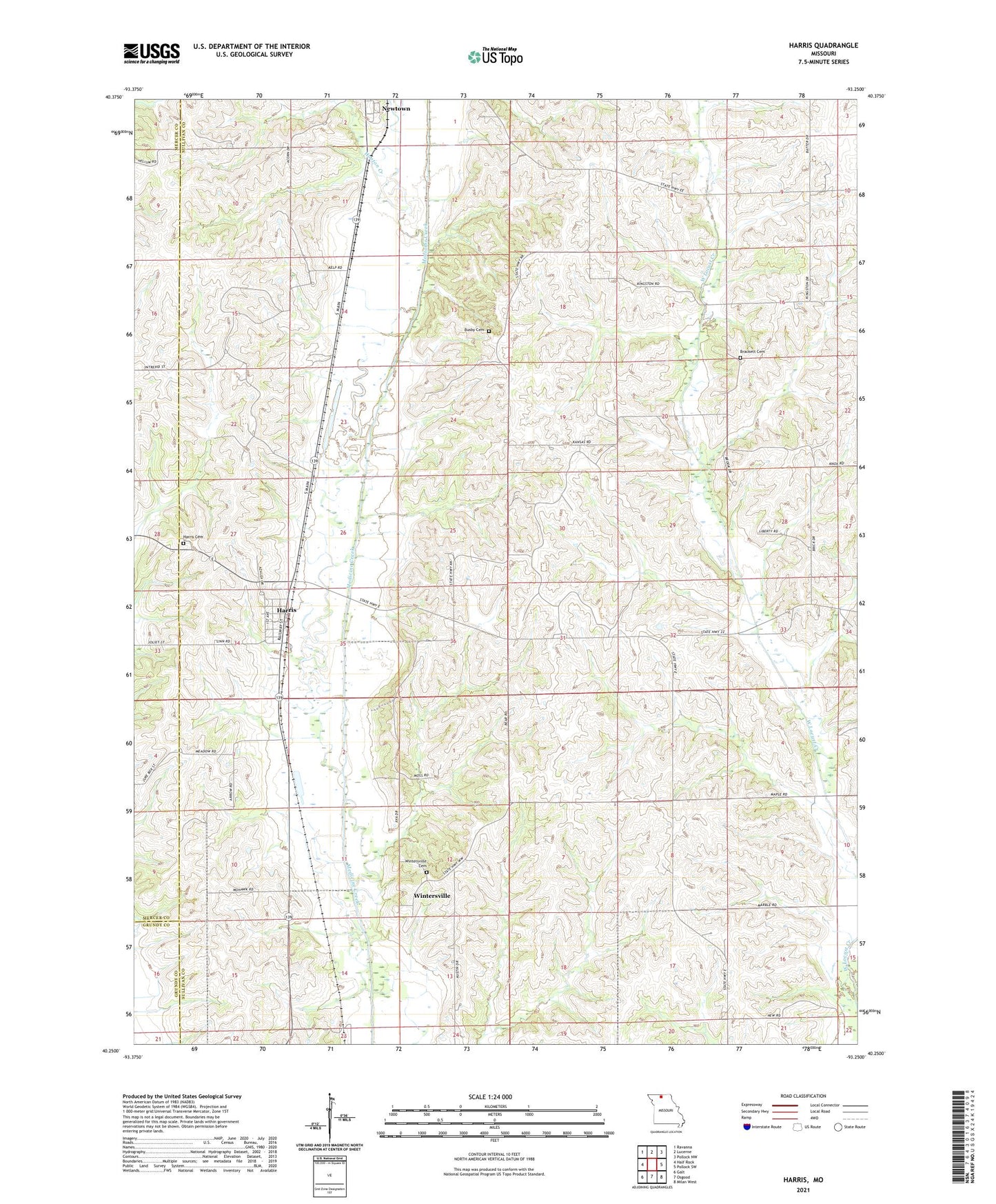
2021 topographic map quadrangle Harris in the state of Missouri. Scale: 1:24000. Based on the newly updated USGS 7.5' US Topo map series, this map is in the following counties: Sullivan, Mercer, Grundy. The map contains contour data, water features, and other items you are used to seeing on USGS maps, but also has updated roads and other features. This is the next generation of topographic maps. Printed on high-quality waterproof paper with UV fade-resistant inks.
Quads adjacent to this one:
West: Half Rock
Northwest: Ravanna
North: Lucerne
Northeast: Pollock NW
East: Pollock SW
Southeast: Milan West
South: Osgood
Southwest: Galt
Contains the following named places: Asbury Church, Brackett Cemetery, Busby Cemetery, Center Grove Church, Center Grove School, Colfax School, Enterprise School, Griffith School, Harris, Harris Cemetery, Harris Fire Department, Hooton Creek, Jones School, Pine School, Reed School, Town of Harris, Township of Clay, Township of Liberty, Wintersville, Wintersville Cemetery, Wintersville School, ZIP Code: 64645