MyTopo
Pollock NW Missouri US Topo Map
Couldn't load pickup availability
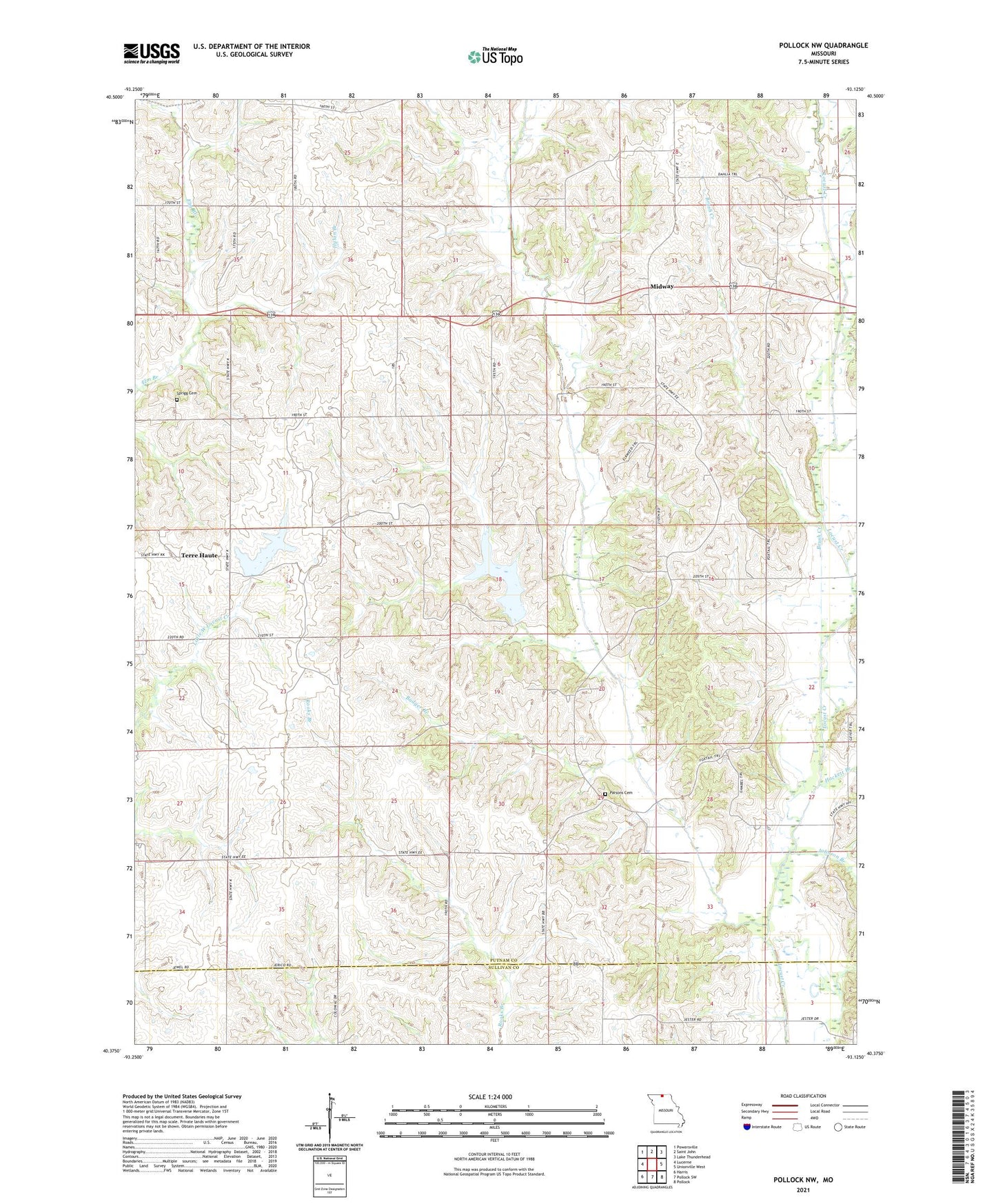
2021 topographic map quadrangle Pollock NW in the state of Missouri. Scale: 1:24000. Based on the newly updated USGS 7.5' US Topo map series, this map is in the following counties: Putnam, Sullivan. The map contains contour data, water features, and other items you are used to seeing on USGS maps, but also has updated roads and other features. This is the next generation of topographic maps. Printed on high-quality waterproof paper with UV fade-resistant inks.
Quads adjacent to this one:
West: Lucerne
Northwest: Powersville
North: Saint John
Northeast: Lake Thunderhead
East: Unionville West
Southeast: Pollock
South: Pollock SW
Southwest: Harris
This map covers the same area as the classic USGS quad with code o40093d2.
Contains the following named places: Badger Branch, Brush Creek, Cullor Lake Dam, Elm Branch School, Hackett Branch, Hill School, Hylan Branch, Johnson Branch, Jones School, Midway, Mount Vernon School, Parsons Cemetery, Pearson School, Plainview Church, Quinn, Sprigg Cemetery, Terre Haute, Terre Haute School, Township of Jackson, Union Grove Church, Watkins Creek, West Concord Church, West Liberty, West Liberty Church, West Liberty School, West Locust Creek