MyTopo
Half Rock Missouri US Topo Map
Couldn't load pickup availability
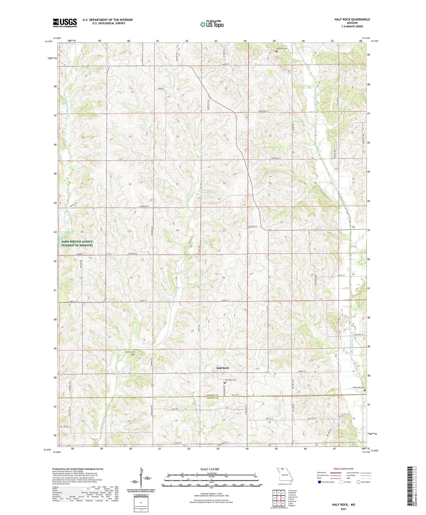
2021 topographic map quadrangle Half Rock in the state of Missouri. Scale: 1:24000. Based on the newly updated USGS 7.5' US Topo map series, this map is in the following counties: Mercer, Grundy. The map contains contour data, water features, and other items you are used to seeing on USGS maps, but also has updated roads and other features. This is the next generation of topographic maps. Printed on high-quality waterproof paper with UV fade-resistant inks.
Quads adjacent to this one:
West: Mill Grove
Northwest: Princeton
North: Ravanna
Northeast: Lucerne
East: Harris
Southeast: Osgood
South: Galt
Southwest: Spickard
This map covers the same area as the classic USGS quad with code o40093c4.
Contains the following named places: Barnes Cemetery, Bellview School, Boatman School, Brantley Cemetery, Brantley School, Burkeholder School, Farmers Valley School, Half Rock, Half Rock Cemetery, Hammond Brothers Lake, Hammond Brothers Lake Dam, Hunter Church, Lyons School, Pilot Knob School, Prairie School, Rhoades School, Smith School, Topsy, Topsy Church, Topsy School, Township of Medicine, White Oak Cemetery