MyTopo
Harviell Missouri US Topo Map
Couldn't load pickup availability
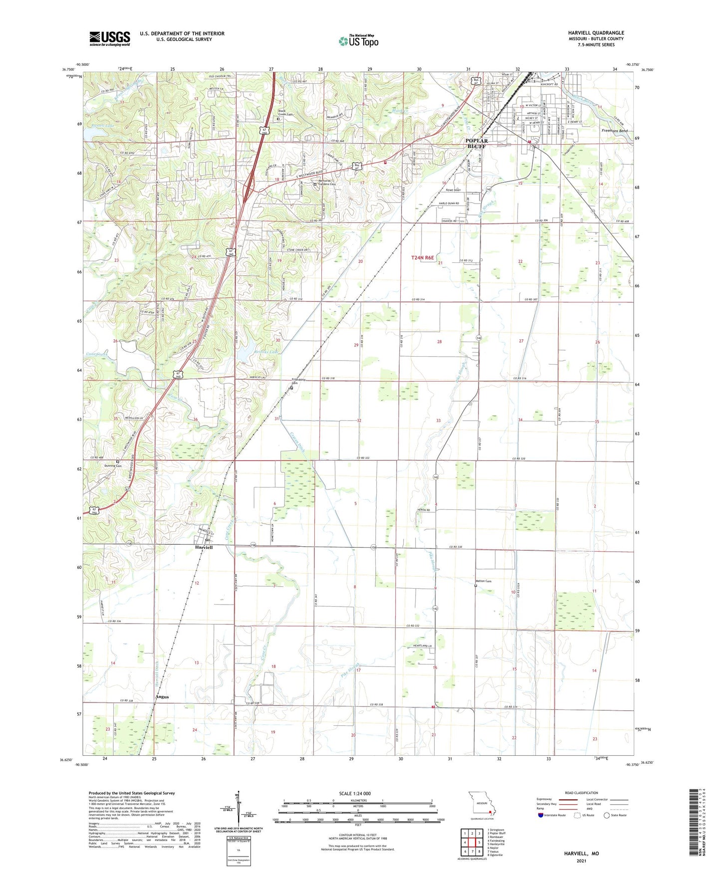
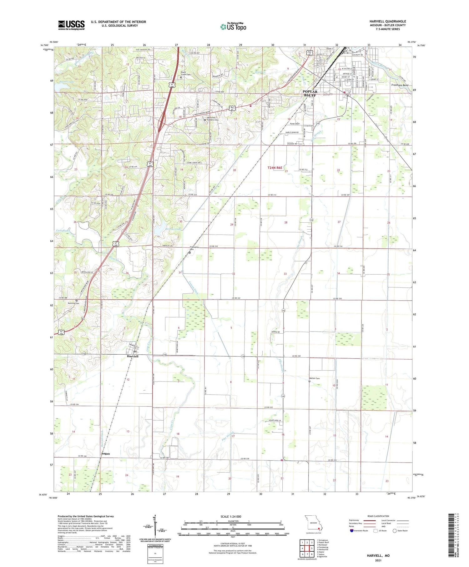
2021 topographic map quadrangle Harviell in the state of Missouri. Scale: 1:24000. Based on the newly updated USGS 7.5' US Topo map series, this map is in the following counties: Butler. The map contains contour data, water features, and other items you are used to seeing on USGS maps, but also has updated roads and other features. This is the next generation of topographic maps. Printed on high-quality waterproof paper with UV fade-resistant inks.
Quads adjacent to this one:
West: Fairdealing
Northwest: Stringtown
North: Poplar Bluff
Northeast: Rombauer
East: Hanleyville
Southeast: Oglesville
South: Vastus
Southwest: Naylor
Contains the following named places: Alfrey, Angus, Ashcroft Addition, Black Creek, Black Creek Cemetery, Black Creek Church, Butler County, Butler County Fire Protection District Main Station, Butler County Fire Protection District Pike Slough Station, Craven Ditch, Cravens Chapel, Cravens School, Dunning Cemetery, Emmanuel Missionary Church, Eugene Field School, Freemans Bend, Friendship Cemetery, Harviell, Harviell Census Designated Place, Harviell Ditch, Harviell Post Office, Lake Christene, Lake Christene Dam, Linstead, Little Brown Church, Lone Star Church, Main Ditch, Melton Cemetery, Memorial Gardens Cemetery, Mount Sinai Church, New Light Church, Pike Creek, Pike Slough, Pike Slough School, Pleasant Grove Church, Poplar Bluff Fire Department Station 3, Powers, Resniks Lake, Resniks Lake Dam, Russell Lake, Township of Poplar Bluff, Trinity Missionary Church, Twin Springs Church, Vinegar Hill, Willow Oak School