MyTopo
Holt Missouri US Topo Map
Couldn't load pickup availability
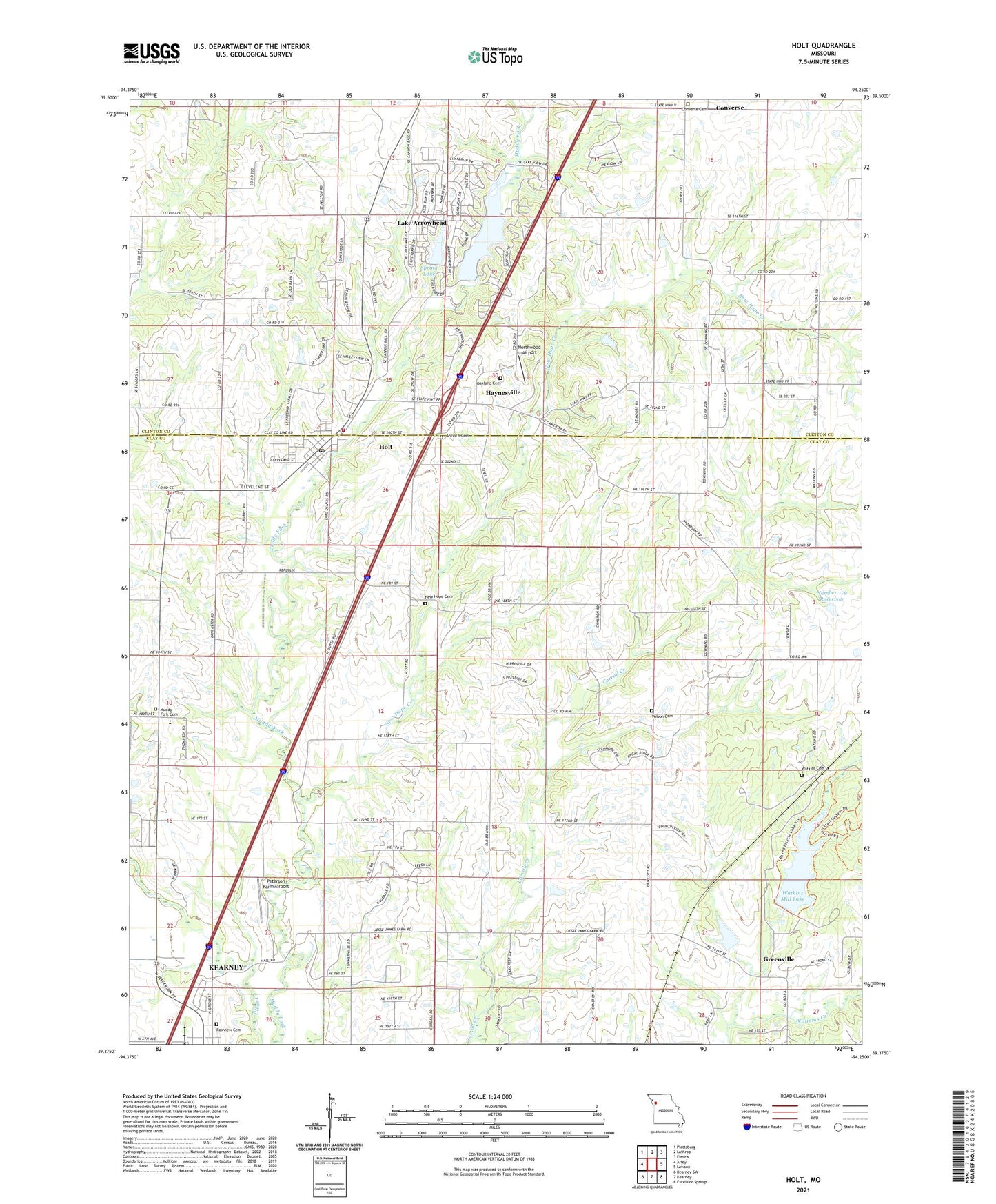
2021 topographic map quadrangle Holt in the state of Missouri. Scale: 1:24000. Based on the newly updated USGS 7.5' US Topo map series, this map is in the following counties: Clay, Clinton. The map contains contour data, water features, and other items you are used to seeing on USGS maps, but also has updated roads and other features. This is the next generation of topographic maps. Printed on high-quality waterproof paper with UV fade-resistant inks.
Quads adjacent to this one:
West: Arley
Northwest: Plattsburg
North: Lathrop
Northeast: Elmira
East: Lawson
Southeast: Excelsior Springs
South: Kearney
Southwest: Kearney SW
Contains the following named places: Antioch Cemetery, Bethel School, City of Holt, Converse, Converse Cemetery, Fairview Cemetery, Grand River Loess Flats and Drift Hills, Greenville, Haynesville, Holt, Holt Community Fire Protection District, Holt Elementary School, Holt Post Office, Huffaker School, Lake Arrowhead, Lake Arrowhead Census Designated Place, Lake Arrowhead Dam, Major, Muddy Fork Cemetery, Muddy Fork School, New Hope Church, New Hope Creek, Northwood Airport, Number 179 Reservoir, Oakland Cemetery, Peterson Farm Airport, Pleasant Grove School, Sellers Airport, Spring Lake, Spring Lake Dam, Structure Number 1 Williams Creek Dam, Summerset School, Sunny Grove School, Township of Jackson, Township of Washington, Watkins Cemetery, Watkins Mill Dam, Watkins Mill Lake, Watkins Mill State Park, Watkins Mill State Park Camp School, Westfall Truck Incorporated Lake Dam, Wilson Cemetery, ZIP Code: 64048