MyTopo
Hunter Missouri US Topo Map
Couldn't load pickup availability
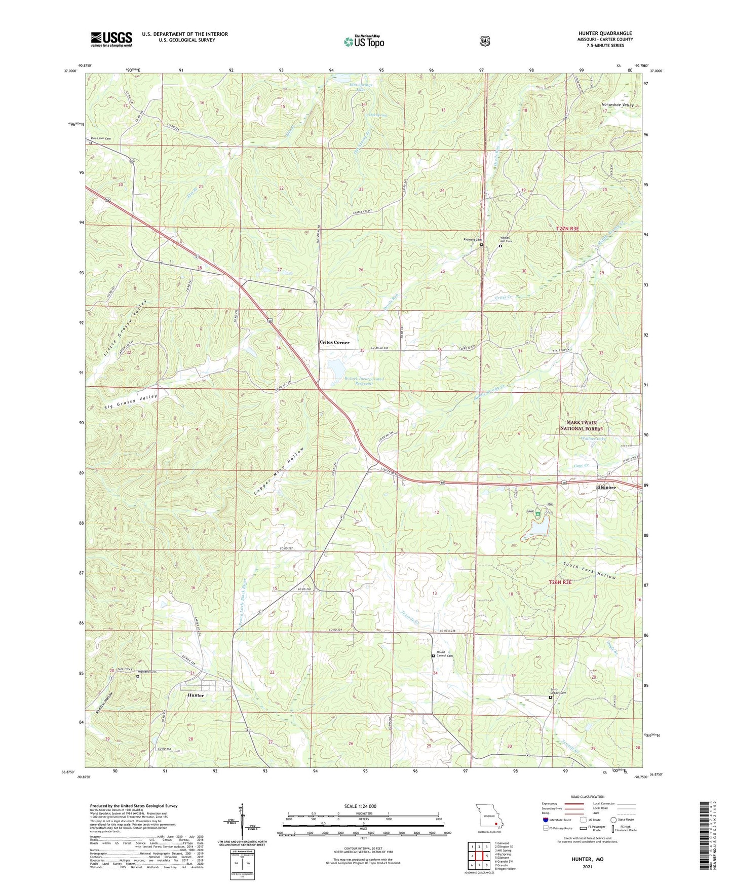
2021 topographic map quadrangle Hunter in the state of Missouri. Scale: 1:24000. Based on the newly updated USGS 7.5' US Topo map series, this map is in the following counties: Carter. The map contains contour data, water features, and other items you are used to seeing on USGS maps, but also has updated roads and other features. This is the next generation of topographic maps. Printed on high-quality waterproof paper with UV fade-resistant inks.
Quads adjacent to this one:
West: Big Spring
Northwest: Garwood
North: Ellington SE
Northeast: Mill Spring
East: Ellsinore
Southeast: Hogan Hollow
South: Grandin
Southwest: Grandin SW
Contains the following named places: Carnahan Lake Dam, Community Church, Crites Corner, Crites Creek, Elm Springs Lake, Elm Springs Lake Dam, Evangelistic Center Church, Grandin Junction, Highland Cemetery, Hunter, Hunter Census Designated Place, Hunter Lookout Tower, Junction Switch, Little Grassy Valley, Mount Carmel Church, Number 445 Dam, Oak Spring, Pine Woods Dam, Pinewoods Lake, Pinewoods Lake Campground, Raymers Cemetery, Rozark Incorporated Reservoir, Smith Chapel, Smith Chapel Cemetery, Township of Jackson, Township of Johnson, Upper Tenmile School, Wallace Lake, Wallace Lake Dam, White Mill School, Whites Mill Cemetery, ZIP Code: 63937