MyTopo
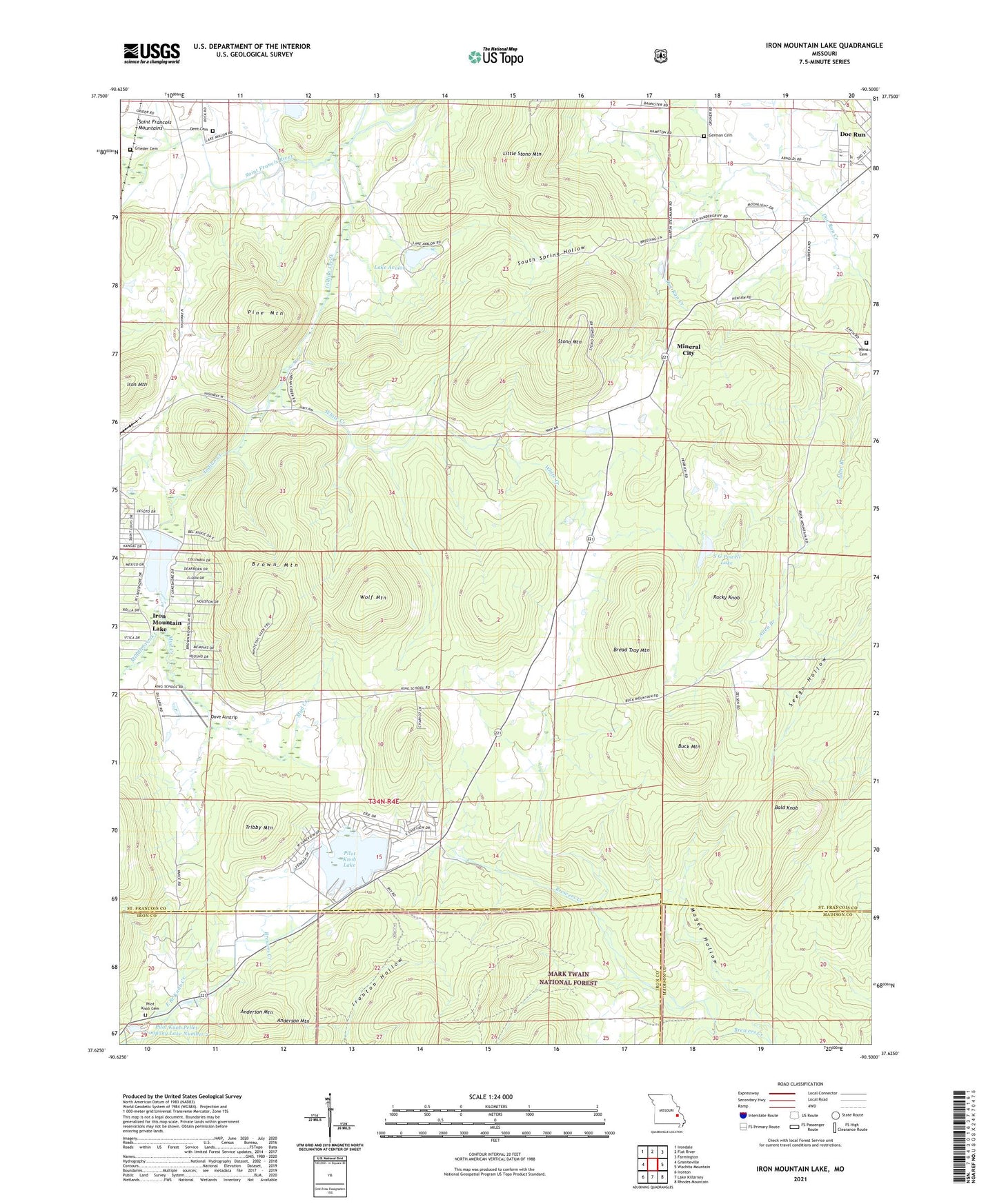
Iron Mountain Lake Missouri US Topo Map
Couldn't load pickup availability
Also explore the Iron Mountain Lake Forest Service Topo of this same quad for updated USFS data
2021 topographic map quadrangle Iron Mountain Lake in the state of Missouri. Scale: 1:24000. Based on the newly updated USGS 7.5' US Topo map series, this map is in the following counties: St. Francois, Iron, Madison. The map contains contour data, water features, and other items you are used to seeing on USGS maps, but also has updated roads and other features. This is the next generation of topographic maps. Printed on high-quality waterproof paper with UV fade-resistant inks.
Quads adjacent to this one:
West: Graniteville
Northwest: Irondale
North: Flat River
Northeast: Farmington
East: Wachita Mountain
Southeast: Rhodes Mountain
South: Lake Killarney
Southwest: Ironton
This map covers the same area as the classic USGS quad with code o37090f5.
Contains the following named places: Anderson Mountain, Assembly of God Church, Bald Knob, Bethel German Methodist Episcopal Church, Bread Tray Mountain, Brown Mountain, Buck Mountain, City of Iron Mountain Lake, Dent Cemetery, Doe Run Lead Mines, Dove Airstrip, German Cemetery, Grieder Cemetery, Indian Creek, Iron Mountain Lake, Iron Mountain Lake Dam, King School, KTJJ-FM (Farmington), Lake 2 Dam, Lake Avalon, Lake Avalon Dam, Lake Number 1 Dam, Little Stono Mountain, Magee Hollow, Middlebrook Creek, Mineral City, Mud Creek, Pilot Knob Cemetery, Pilot Knob Lake, Pilot Knob Pellet Company Lake Number 2, Pine Mountain, Rocky Knob, S G Powell Lake, South Spring Hollow, Stono Mountain, Stono School, Stono Union Church, Sylvan Lake Dam, Township of Iron, Tribby Mountain, Weiss Cemetery, White Creek, Wolf Mountain, ZIP Code: 63637