MyTopo
Jacket Missouri US Topo Map
Couldn't load pickup availability
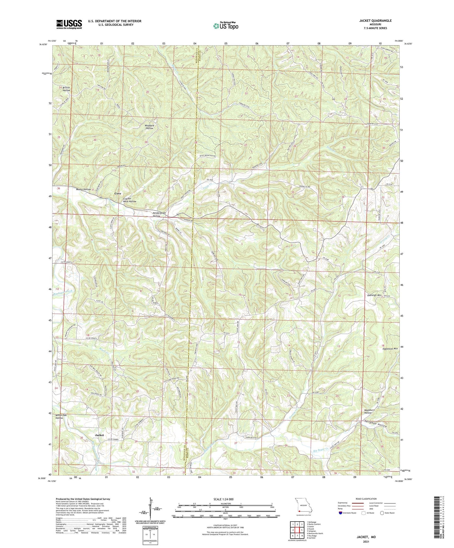
2021 topographic map quadrangle Jacket in the state of Missouri. Scale: 1:24000. Based on the newly updated USGS 7.5' US Topo map series, this map is in the following counties: Barry, McDonald. The map contains contour data, water features, and other items you are used to seeing on USGS maps, but also has updated roads and other features. This is the next generation of topographic maps. Printed on high-quality waterproof paper with UV fade-resistant inks.
Quads adjacent to this one:
West: Powell
Northwest: Bethpage
North: Rocky Comfort
Northeast: Exeter
East: Seligman
Southeast: Garfield
South: Pea Ridge
Southwest: Bentonville North
This map covers the same area as the classic USGS quad with code o36094e1.
Contains the following named places: Antioch Church, Cormus Grove School, Cove, Cracker Neck Hollow, Eggleston Mountain, Flag Pond School, Greasy Creek, Jacket, Lone Walnut School, Maple Grove School, Mayflower, Moore Hollow, Mount Pleasant School, Oakleigh Mountain, OK School, Pender Hollow, Pendergraff Hollow, Seligman Hollow, Township of Ash, Trent Creek School, Washburn Hollow, Washburn Tower Site State Public Hunting Grounds, Washburn Volunteer Fire Department Station 2, White Oak Hollow, ZIP Code: 65772