MyTopo
Rocky Comfort Missouri US Topo Map
Couldn't load pickup availability
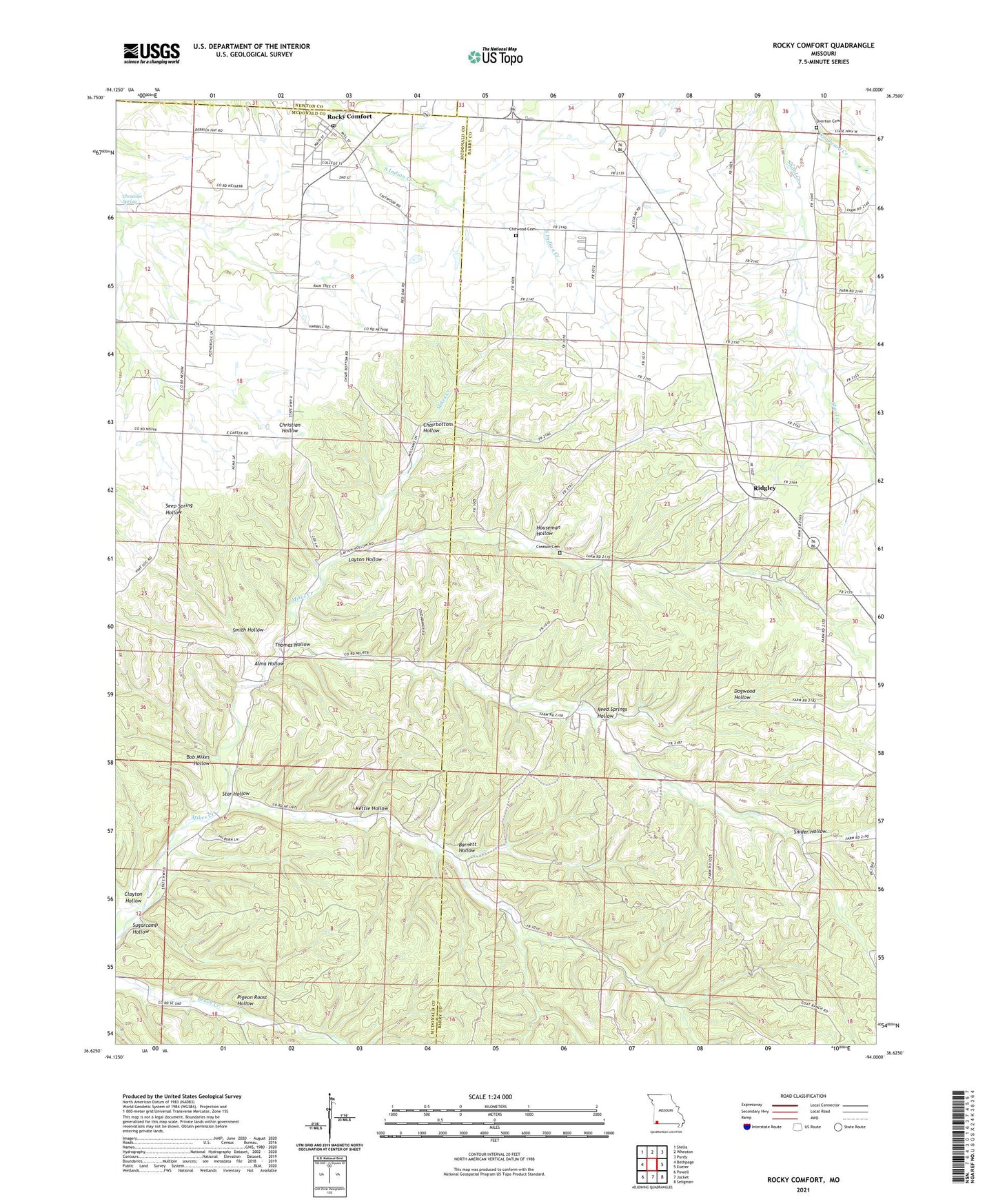
2021 topographic map quadrangle Rocky Comfort in the state of Missouri. Scale: 1:24000. Based on the newly updated USGS 7.5' US Topo map series, this map is in the following counties: Barry, McDonald, Newton. The map contains contour data, water features, and other items you are used to seeing on USGS maps, but also has updated roads and other features. This is the next generation of topographic maps. Printed on high-quality waterproof paper with UV fade-resistant inks.
Quads adjacent to this one:
West: Bethpage
Northwest: Stella
North: Wheaton
Northeast: Purdy
East: Exeter
Southeast: Seligman
South: Jacket
Southwest: Powell
This map covers the same area as the classic USGS quad with code o36094f1.
Contains the following named places: Alma Hollow, Barnett Hollow, Bob Mikes Hollow, Cave Springs School, Chairbottom Hollow, Chitwood Cemetery, Christian Spring, Clayton Hollow, Creason Cemetery, Dogwood Hollow, El Paso, Harrell School, Houseman Hollow, Kettle Hollow, Layton Hollow, Newville, Oklahoma School, Pigeon Roost Hollow, Reed Springs Hollow, Ridgley, Ridgley School, Rocky Comfort, Rocky Comfort Census Designated Place, Rocky Comfort Post Office, Rocky Comfort School, Seven Star School, Smith Hollow, Snider Hollow, Solid Rock Church, Star Hollow, Sugarcamp Hollow, Thomas Hollow, Township of Liberty, Township of Richwood, Union Church, Union Valley School, Wheaton Fire Department Substation, Woodward Creek, ZIP Code: 65647