MyTopo
Kimsey Creek Missouri US Topo Map
Couldn't load pickup availability
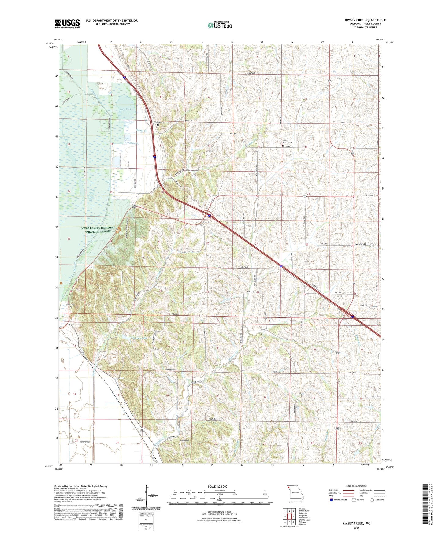
2021 topographic map quadrangle Kimsey Creek in the state of Missouri. Scale: 1:24000. Based on the newly updated USGS 7.5' US Topo map series, this map is in the following counties: Holt. The map contains contour data, water features, and other items you are used to seeing on USGS maps, but also has updated roads and other features. This is the next generation of topographic maps. Printed on high-quality waterproof paper with UV fade-resistant inks.
Quads adjacent to this one:
West: Big Lake
Northwest: Craig
North: Mound City
Northeast: Maitland
East: New Point
Southeast: Forbes
South: Oregon
Southwest: White Cloud
Contains the following named places: Bagby School, Bailey Lake, Bailey Lake Dam, Baldwin Cemetery, Benton Church, Benton School, Blair Creek, Blan School, Bluff Pool, Boyd Cemetery, Brush College Number One School, Cannon Creek, Cannon Creek Diversion, Davis Creek, Eagle Pool, Gordan Lake, Gordan Lake Dam, Holt County, John Hall Dam, John Hall Lake, Kimsey Creek, Kimsey School, Lincoln School, Little Tarkio Creek, Loess Bluffs National Wildlife Refuge, Marion Mendenhall Dam, Monticello School, Number 831 Dam, Oakland School, Roderick Cemetery, Shiloh School, South Bethel Cemetery, Swope Creek, Township of Benton, Union School, Wilson Cemetery, ZIP Code: 64451