MyTopo
Oregon Missouri US Topo Map
Couldn't load pickup availability
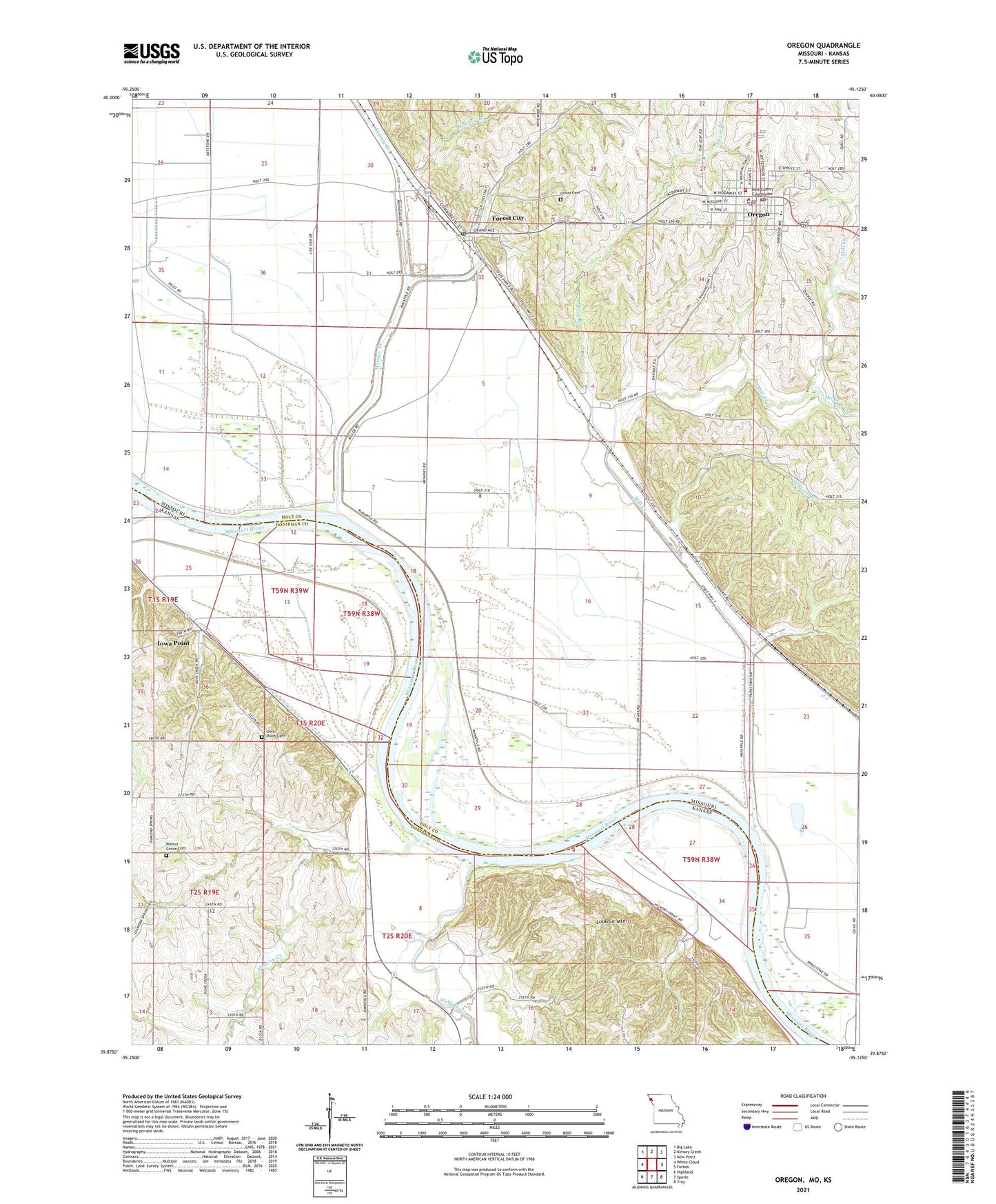
2021 topographic map quadrangle Oregon in the states of Missouri, Kansas. Scale: 1:24000. Based on the newly updated USGS 7.5' US Topo map series, this map is in the following counties: Holt, Doniphan. The map contains contour data, water features, and other items you are used to seeing on USGS maps, but also has updated roads and other features. This is the next generation of topographic maps. Printed on high-quality waterproof paper with UV fade-resistant inks.
Quads adjacent to this one:
West: White Cloud
Northwest: Big Lake
North: Kimsey Creek
Northeast: New Point
East: Forbes
Southeast: Troy
South: Sparks
Southwest: Highland
This map covers the same area as the classic USGS quad with code o39095h2.
Contains the following named places: Bluff City School, Chambers School, City of Forest City, City of Oregon, Curzon, Davis Branch, Fitzmaurice Lake, Forest City, Forest City Post Office, Hickory Creek, Holt County Sheriff's Office, Howley Branch, Iowa Point, Iowa Point Cemetery, Lookout Mountain, Martin School, Mill Creek, Mission Creek, Oregon, Oregon Police Department, Oregon Post Office, Rock Creek, Schaefer School, Schlotz Branch, South Holt Elementary School, South Holt High School, Southern Fire Protection District, Township of Forest, Township of Lewis, Union Cemetery, Walnut Grove Cemetery, Welty Park, Willow Spring School, Wolf River