MyTopo
Craig Missouri US Topo Map
Couldn't load pickup availability
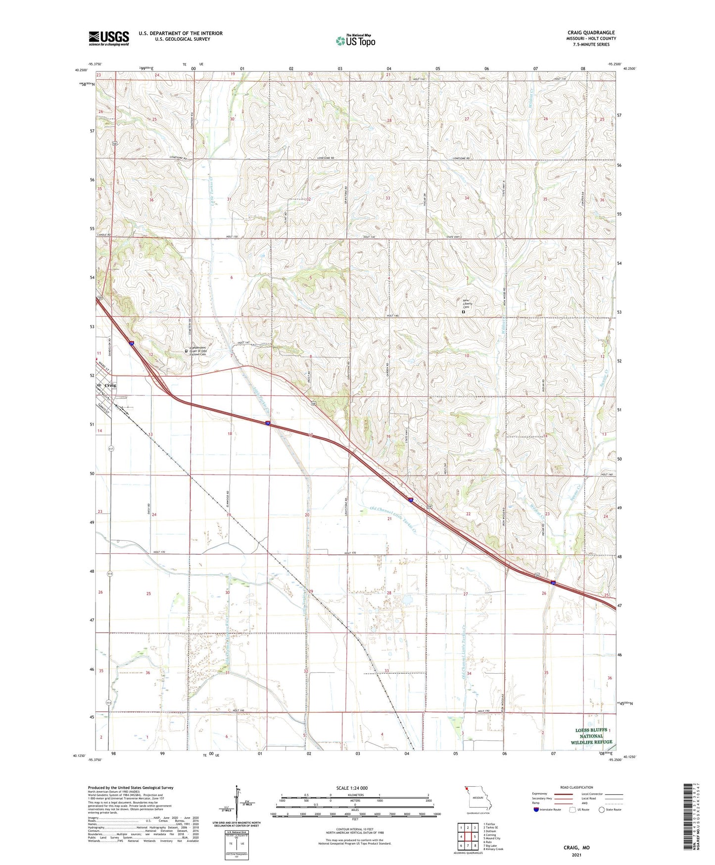
2023 topographic map quadrangle Craig in the state of Missouri. Scale: 1:24000. Based on the newly updated USGS 7.5' US Topo map series, this map is in the following counties: Holt. The map contains contour data, water features, and other items you are used to seeing on USGS maps, but also has updated roads and other features. This is the next generation of topographic maps. Printed on high-quality waterproof paper with UV fade-resistant inks.
Quads adjacent to this one:
West: Corning
Northwest: Fairfax
North: Tarkio SE
Northeast: Dotham
East: Mound City
Southeast: Kimsey Creek
South: Big Lake
Southwest: Rulo
This map covers the same area as the classic USGS quad with code o40095b3.
Contains the following named places: Bellevue School, Browning Lake, Browning Lake Dam, Brush College School, Cherrydale School, City of Craig, Craig, Craig Post Office, Craig Volunteer Fire Department Holt Station 1, Dale Center School, East Branch Squaw Creek, East Fork Little Tarkio Creek, Independent Order of Odd Fellows Cemetery, Liberty School, Lonesome School, Mount Hope School, Nauman Lake, Nauman Lake Dam, New Liberty Cemetery, Squaw Creek, Summit School, Wild Rose School, Wildcat Creek