MyTopo
Big Lake Missouri US Topo Map
Couldn't load pickup availability
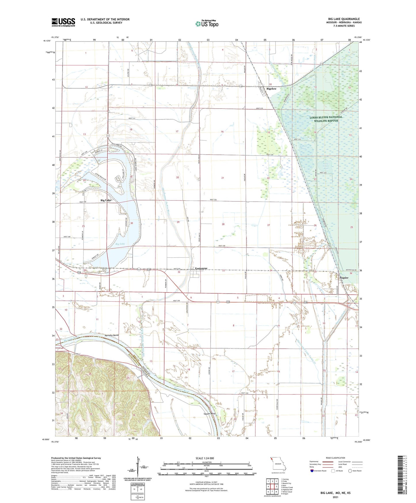
2023 topographic map quadrangle Big Lake in the states of Missouri, Nebraska. Scale: 1:24000. Based on the newly updated USGS 7.5' US Topo map series, this map is in the following counties: Holt, Richardson, Brown. The map contains contour data, water features, and other items you are used to seeing on USGS maps, but also has updated roads and other features. This is the next generation of topographic maps. Printed on high-quality waterproof paper with UV fade-resistant inks.
Quads adjacent to this one:
West: Rulo
Northwest: Corning
North: Craig
Northeast: Mound City
East: Kimsey Creek
Southeast: Oregon
South: White Cloud
Southwest: Highland NW
Contains the following named places: Big Lake, Big Lake State Park, Bigelow, Cottonwood School, Davis Creek Ditch, Elm Grove School, Exodus School, Fortescue, Glendale School, Idlewild School, Main Pool, Mallard Marsh, Napier, Nemaha Bends, Nohart, Nohart Post Office, Old Channel Little Tarkio Creek, Old Channel Tarkio River, Pelican Pool, Pintail Pool, Sixth Principal Meridian Historical Marker, Snow Goose Pool, South Levee, Squaw Bend, Squaw Creek Ditch, Town of Fortescue, Township of Bigelow, Township of Minton, Village of Big Lake, Village of Bigelow, Walnut Grove School, ZIP Code: 64437