MyTopo
Forbes Missouri US Topo Map
Couldn't load pickup availability
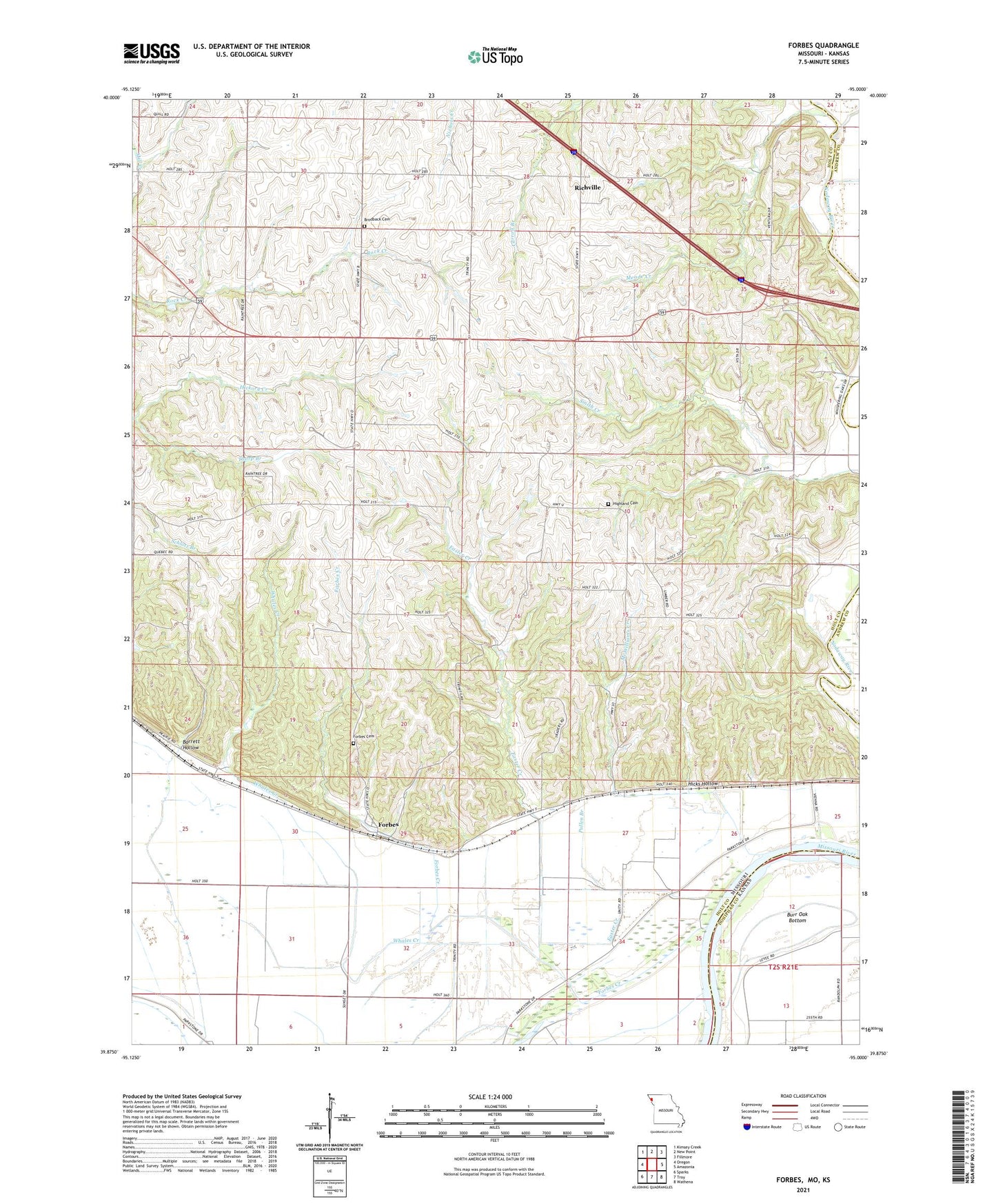
2021 topographic map quadrangle Forbes in the states of Missouri, Kansas. Scale: 1:24000. Based on the newly updated USGS 7.5' US Topo map series, this map is in the following counties: Holt, Doniphan, Andrew. The map contains contour data, water features, and other items you are used to seeing on USGS maps, but also has updated roads and other features. This is the next generation of topographic maps. Printed on high-quality waterproof paper with UV fade-resistant inks.
Quads adjacent to this one:
West: Oregon
Northwest: Kimsey Creek
North: New Point
Northeast: Fillmore
East: Amazonia
Southeast: Wathena
South: Troy
Southwest: Sparks
This map covers the same area as the classic USGS quad with code o39095h1.
Contains the following named places: Barrett Hollow, Brodback Cemetery, Burr Oak School, Culp School, Dyer Branch, Easter Creek, Forbes, Forbes Cemetery, Forbes Creek, Frank Milne Dam, Hicks Hollow, Highland Cemetery, Highland School, Lincoln Creek, Markt Air Strip Airport, Mayflower School, McWilliams Creek, Meade Creek, Milne Lake, Monarch School, Oak Grove School, Pierce School, Pullen Branch, Richville, Riverbreaks Conservation Area, Thorp Branch, Township of Forbes, Whales Creek, White School, Wood School, Woodville Church, ZIP Code: 64473