MyTopo
Knox City Missouri US Topo Map
Couldn't load pickup availability
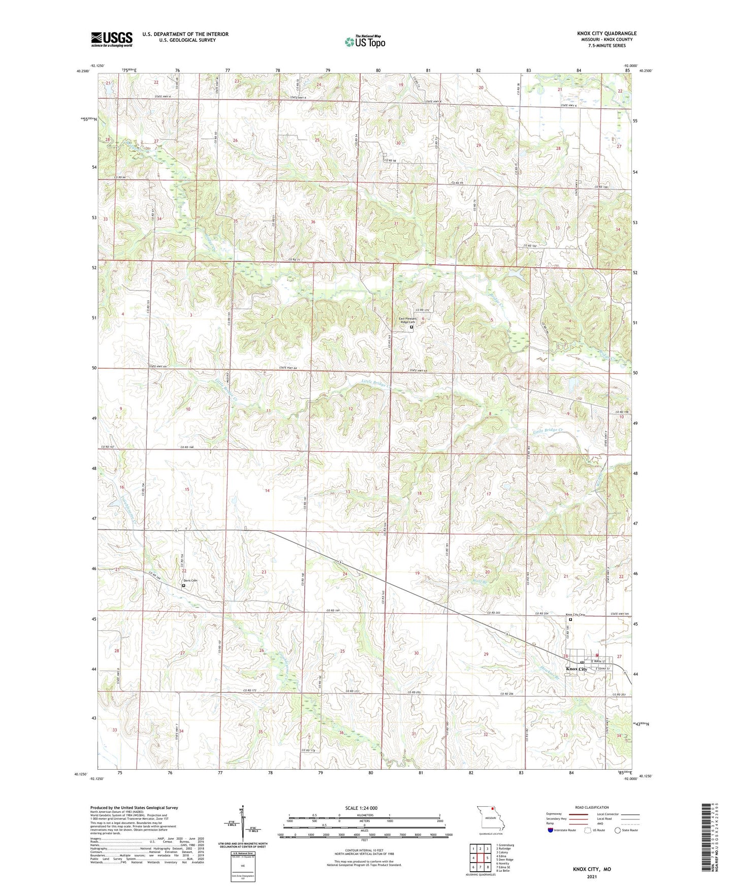
2021 topographic map quadrangle Knox City in the state of Missouri. Scale: 1:24000. Based on the newly updated USGS 7.5' US Topo map series, this map is in the following counties: Knox. The map contains contour data, water features, and other items you are used to seeing on USGS maps, but also has updated roads and other features. This is the next generation of topographic maps. Printed on high-quality waterproof paper with UV fade-resistant inks.
Quads adjacent to this one:
West: Edina
Northwest: Greensburg
North: Rutledge
Northeast: Colony
East: Deer Ridge
Southeast: La Belle
South: Edina SE
Southwest: Novelty
Contains the following named places: Antioch School, Brushey School, Buttermilk, City of Knox City, Cottey Creek, Crim School, Davis Cemetery, East Pleasant Ridge Cemetery, Jett School, Joe D Lewis Airport, Knox City, Knox City and Rural Fire Department, Knox City Cemetery, Knox City Post Office, KRXL-FM (Kirksville), KTVO-TV (Kirksville), Musser School, Rule School, Township of Liberty, Township of Myrtle, Twin Church, Vice School, White Oak School, Wilson Lake, Wilson Lake Dam, Wolf Branch