MyTopo
Greensburg Missouri US Topo Map
Couldn't load pickup availability
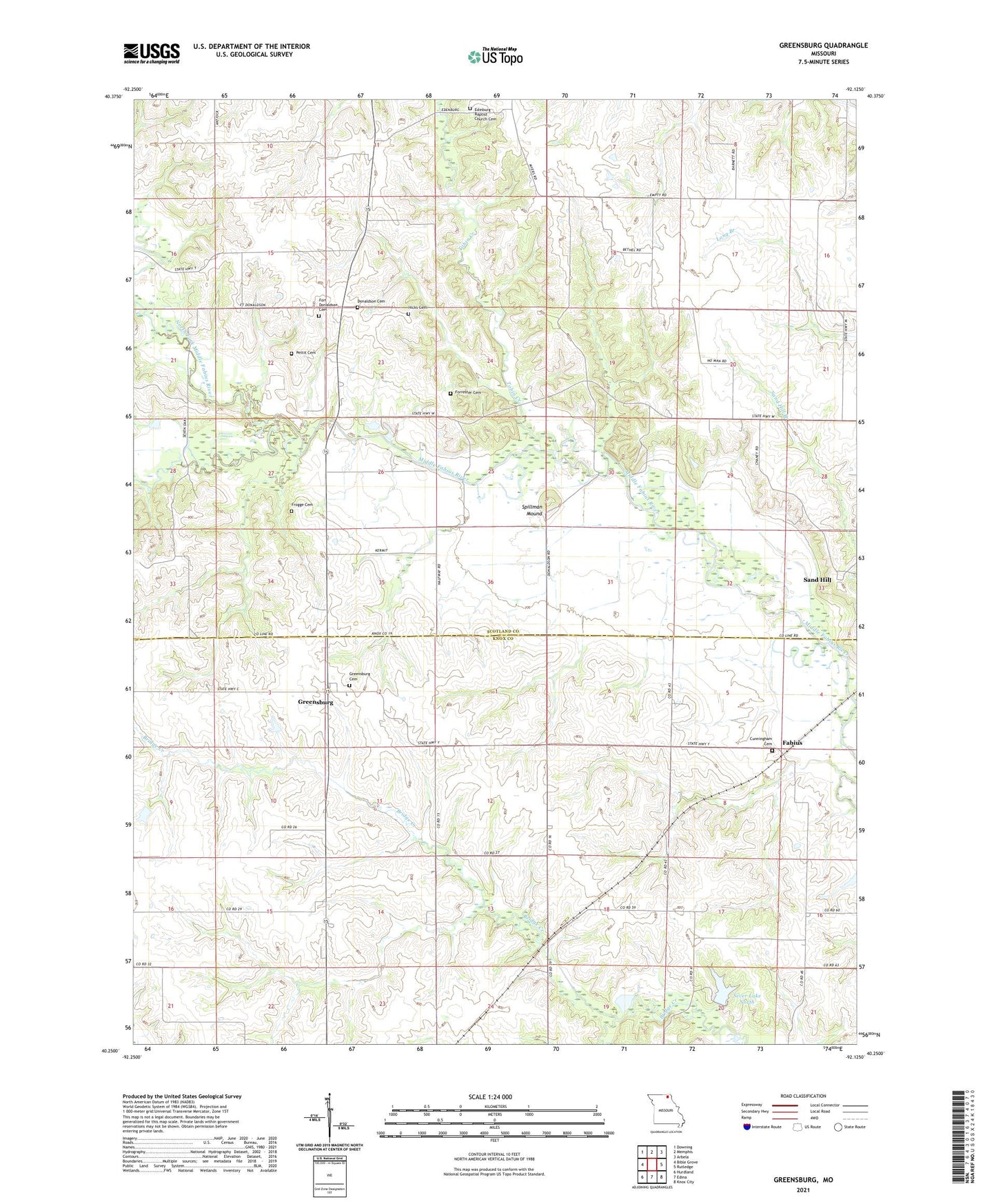
2021 topographic map quadrangle Greensburg in the state of Missouri. Scale: 1:24000. Based on the newly updated USGS 7.5' US Topo map series, this map is in the following counties: Scotland, Knox. The map contains contour data, water features, and other items you are used to seeing on USGS maps, but also has updated roads and other features. This is the next generation of topographic maps. Printed on high-quality waterproof paper with UV fade-resistant inks.
Quads adjacent to this one:
West: Bible Grove
Northwest: Downing
North: Memphis
Northeast: Arbela
East: Rutledge
Southeast: Knox City
South: Edina
Southwest: Hurdland
This map covers the same area as the classic USGS quad with code o40092c2.
Contains the following named places: Bethel Church, Chaney School, Cunningham Cemetery, Donaldson Cemetery, Dromey Airport, Edinburg, Edinburg Baptist Church, Edinburg Baptist Church Cemetery, Fabius, Fabius School, Forrester Cemetery, Fort Donaldson Cemetery, Fort Donaldson School, Frogge Cemetery, Frogge School, Greensburg, Greensburg Cemetery, Henrichs School, Hicks Cemetery, Kiley School, Myers School, North Fork Middle Fabius River, Pettit Cemetery, Pleasant Retreat, Pleasant Ridge Post Office, Ruskin, Ruskin Post Office, Sand Hill, Sever Lake North, Sever Lake North Dam, South Fork Middle Fabius River, Spillman Mound, Tobin Creek, Township of Tobin, ZIP Code: 63531