MyTopo
Tarkio West Missouri US Topo Map
Couldn't load pickup availability
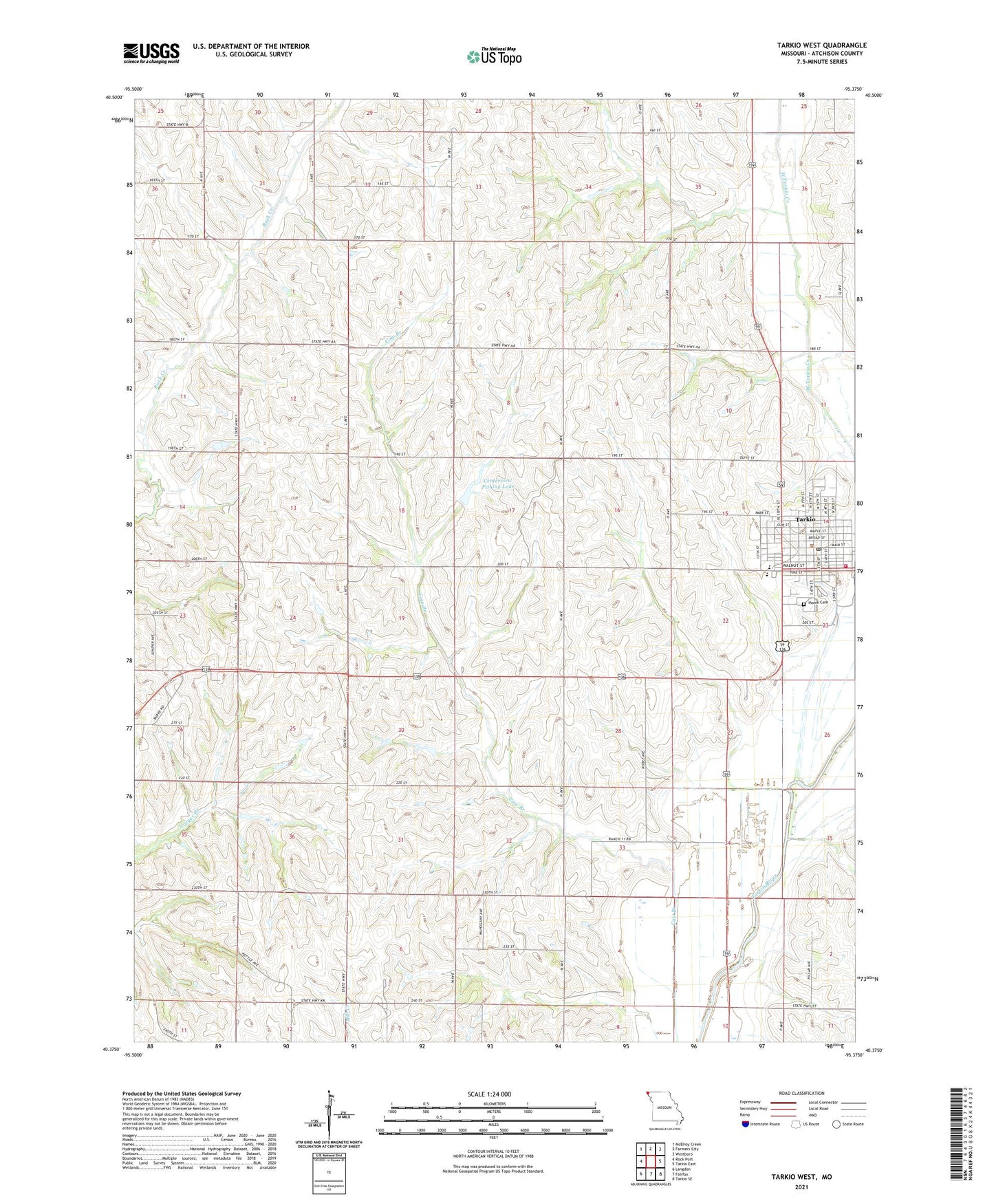
2021 topographic map quadrangle Tarkio West in the state of Missouri. Scale: 1:24000. Based on the newly updated USGS 7.5' US Topo map series, this map is in the following counties: Atchison. The map contains contour data, water features, and other items you are used to seeing on USGS maps, but also has updated roads and other features. This is the next generation of topographic maps. Printed on high-quality waterproof paper with UV fade-resistant inks.
Quads adjacent to this one:
West: Rock Port
Northwest: McElroy Creek
North: Farmers City
Northeast: Westboro
East: Tarkio East
Southeast: Tarkio SE
South: Fairfax
Southwest: Langdon
This map covers the same area as the classic USGS quad with code o40095d4.
Contains the following named places: Atchison County, Broady Lake Dam, Centerview Fishing Lake, Central School, City of Tarkio, Cloverhill School, High Bank School, Home Cemetery, Jeff Broady Lake, KTRX-FM (Tarkio), Liberty School, Loss Grove School, Mononame 283 Dam, National School, Oak Grove School, Opp School, Royal School, Rupes Grove School, Tarkio, Tarkio Academy, Tarkio Elementary School, Tarkio Fire Department, Tarkio High School, Tarkio Police Department, Tarkio Post Office, Township of Tarkio