MyTopo
Laredo Missouri US Topo Map
Couldn't load pickup availability
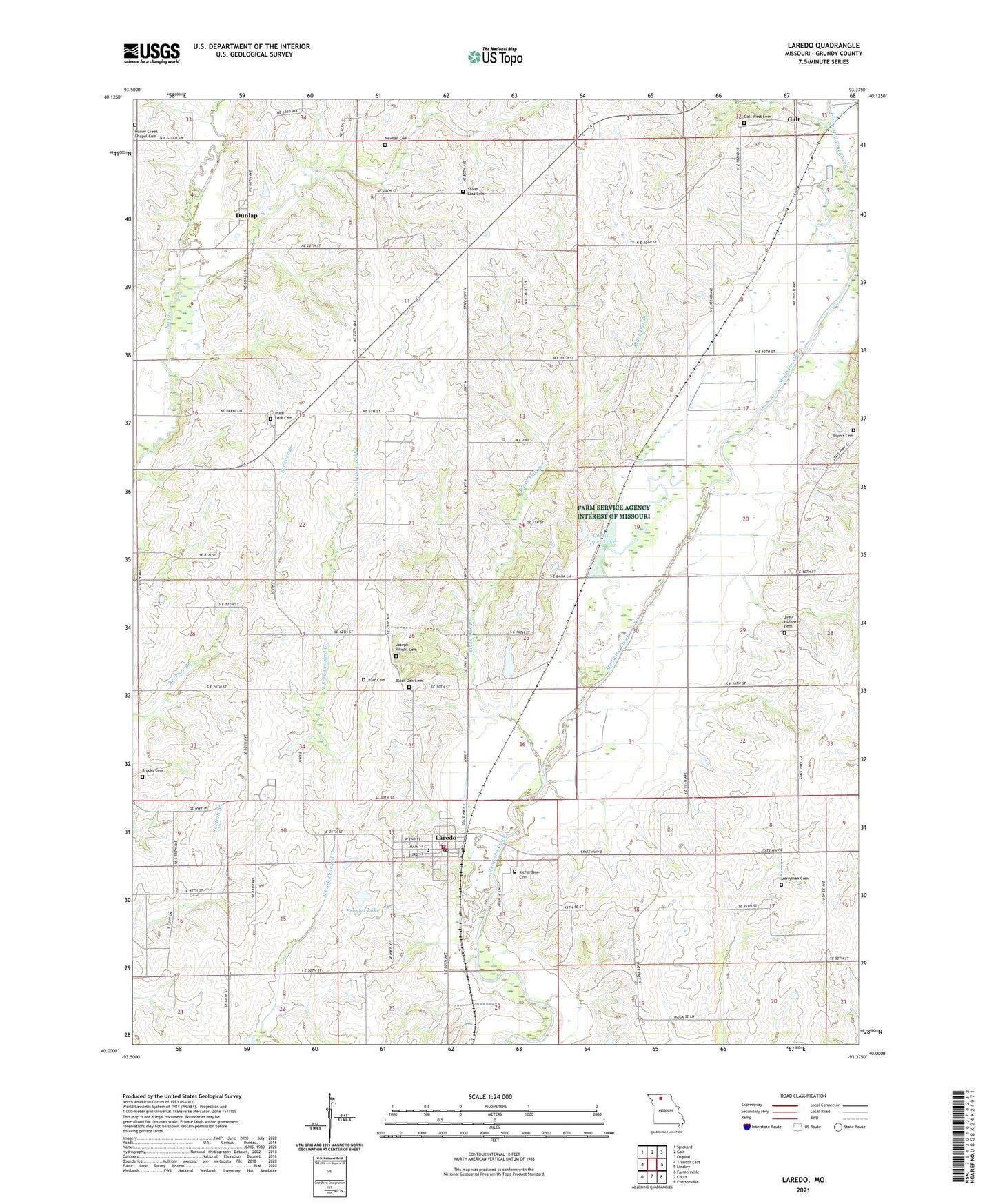
2021 topographic map quadrangle Laredo in the state of Missouri. Scale: 1:24000. Based on the newly updated USGS 7.5' US Topo map series, this map is in the following counties: Grundy. The map contains contour data, water features, and other items you are used to seeing on USGS maps, but also has updated roads and other features. This is the next generation of topographic maps. Printed on high-quality waterproof paper with UV fade-resistant inks.
Quads adjacent to this one:
West: Trenton East
Northwest: Spickard
North: Galt
Northeast: Osgood
East: Lindley
Southeast: Eversonville
South: Chula
Southwest: Farmersville
Contains the following named places: Barr Cemetery, Bethel School, Black Oak Branch, Black Oak Cemetery, Black Oak Church, Black Oak School, Boyers Cemetery, Brooks Cemetery, Broyles Lake, Broyles Lake Dam, Center Union School, City of Laredo, Curtis Upper Lake, Curtiss Lake Dam, Dunlap, Forest Hill School, Galt West Cemetery, Honey Creek Chapel Cemetery, Honey Creek School, Joab Holloway Cemetery, Joseph Wright Cemetery, Laredo, Laredo Elementary School, Laredo Fire Department and Ambulance Service, Laredo Post Office, Little Medicine Creek, Marion Center School, Merryman Cemetery, Newlan Cemetery, Richardson Cemetery, Rural Dale Cemetery, Rural Dale Church, Rural Dale School, Salem Church, Salem East Cemetery, Sinia School, Township of Marion, Union Grove School, ZIP Code: 64652