MyTopo
Spickard Missouri US Topo Map
Couldn't load pickup availability
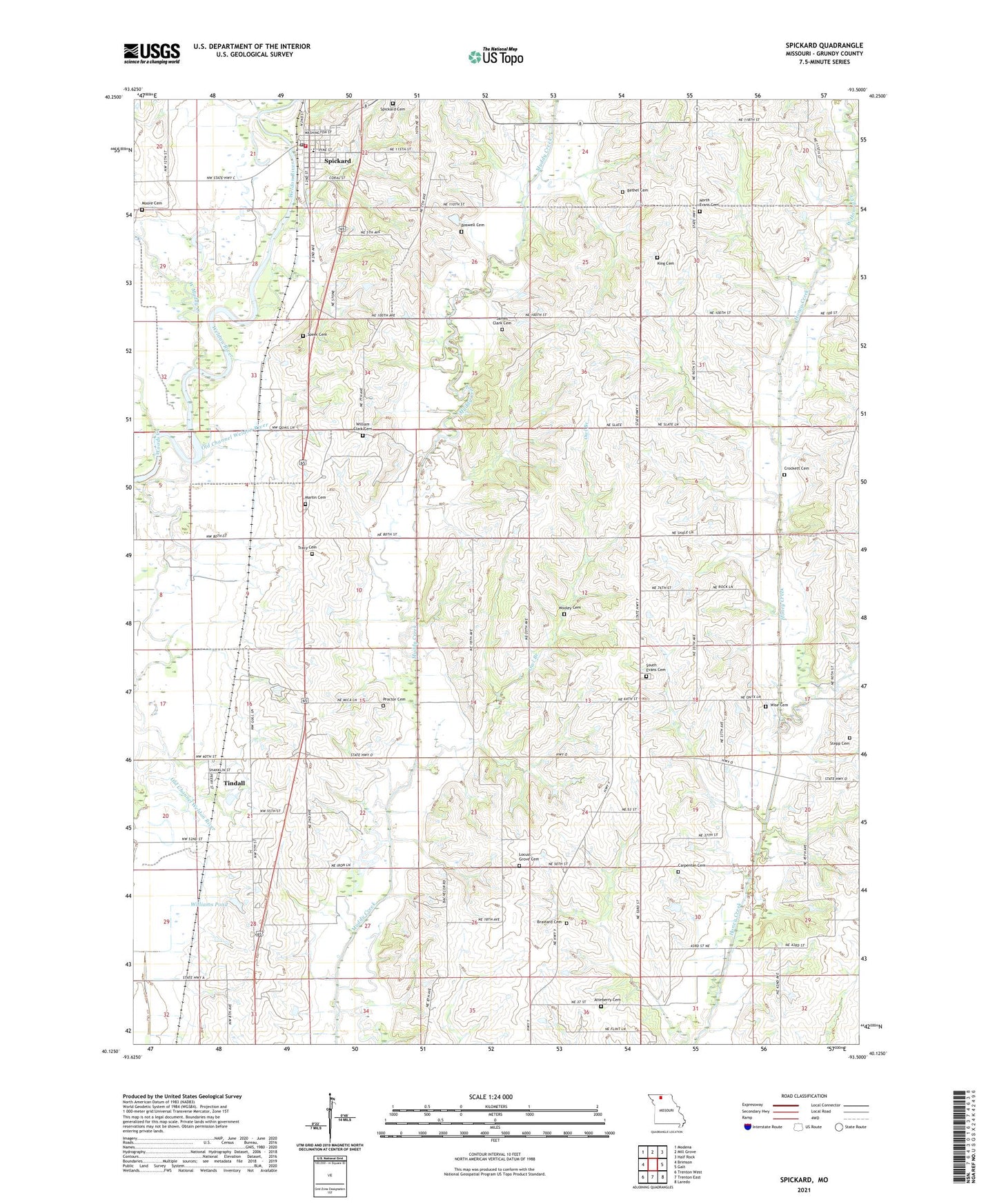
2021 topographic map quadrangle Spickard in the state of Missouri. Scale: 1:24000. Based on the newly updated USGS 7.5' US Topo map series, this map is in the following counties: Grundy. The map contains contour data, water features, and other items you are used to seeing on USGS maps, but also has updated roads and other features. This is the next generation of topographic maps. Printed on high-quality waterproof paper with UV fade-resistant inks.
Quads adjacent to this one:
West: Brimson
Northwest: Modena
North: Mill Grove
Northeast: Half Rock
East: Galt
Southeast: Laredo
South: Trenton East
Southwest: Trenton West
This map covers the same area as the classic USGS quad with code o40093b5.
Contains the following named places: Amick School, Atteberry Cemetery, Bethel Cemetery, Boswell Cemetery, Brainard Cemetery, Carpenter Cemetery, City of Spickard, Crockett Cemetery, Denslow School, East Honey Creek, Gehlbach School, Herbert School, James Clark Cemetery, King Cemetery, Locust Grove Cemetery, Locust Grove School, Martin Cemetery, Moore Cemetery, North Evans Cemetery, Oak Ridge School, Owl Branch, Paint Lick Church, Proctor Cemetery, South Evans Cemetery, South Evans Church, Speer Cemetery, Spickard, Spickard Cemetery, Spickard Elementary School, Spickard Fire Department, Spickard Post Office, Steinhoff Lake Dam, Stepp Cemetery, Terry George School, Tindall, Tindall School, Town of Tindall, Township of Franklin, Township of Lincoln, Tracy Cemetery, Veatch Lake Dam, West Honey Creek, West Muddy Creek, William Clark Cemetery, Williams Pond, Williams School, Wise Cemetery, Woods Creek, Wooley Cemetery, Wyandotte, ZIP Code: 64679