MyTopo
Farmersville Missouri US Topo Map
Couldn't load pickup availability
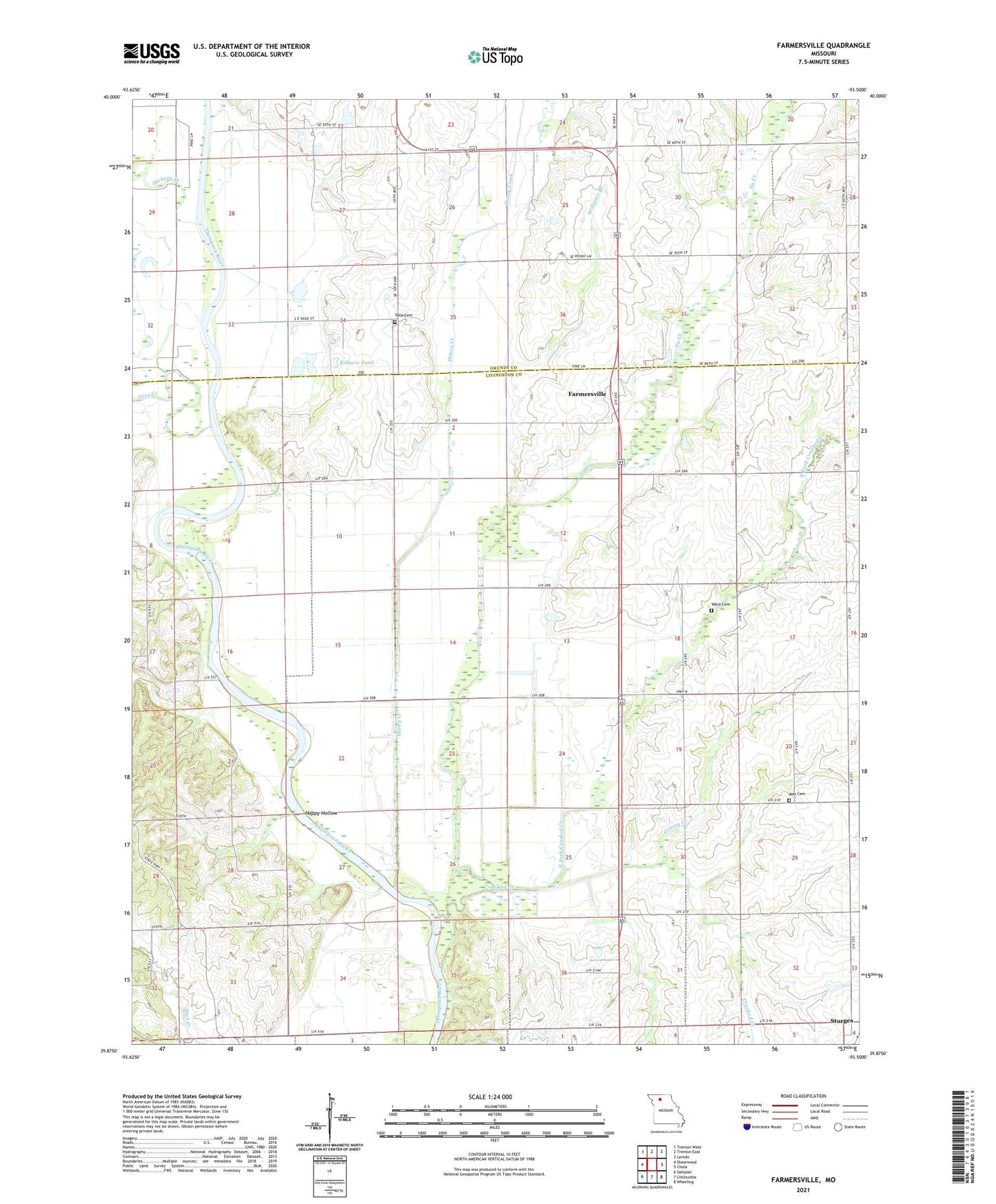
2021 topographic map quadrangle Farmersville in the state of Missouri. Scale: 1:24000. Based on the newly updated USGS 7.5' US Topo map series, this map is in the following counties: Livingston, Grundy. The map contains contour data, water features, and other items you are used to seeing on USGS maps, but also has updated roads and other features. This is the next generation of topographic maps. Printed on high-quality waterproof paper with UV fade-resistant inks.
Quads adjacent to this one:
West: Shearwood
Northwest: Trenton West
North: Trenton East
Northeast: Laredo
East: Chula
Southeast: Wheeling
South: Chillicothe
Southwest: Sampsel
This map covers the same area as the classic USGS quad with code o39093h5.
Contains the following named places: Akers Lake Dam, American Bottoms School, Bethards Lake Dam, Black Hills School, Center School, Crooked Creek, Farmersville, Fay Lake Dam, Feeney Lake Dam, Frost Lake Dam, Gees Creek, Grassy Creek, Happy Hollow, Happy Hollow School, Hazelhurst School, Hickory Creek, Honey Creek, Kilburn Dam, Kilburn Pond, Liberty School, Mack and Woodard Lake Section 22 Dam, May Cemetery, No Creek, North Fork Crooked Creek, Pleasant Grove School, Potter School, Prairie Valley School, Silverleaf, Sturges, Tolle Cemetery, Township of Cream Ridge, Township of Jackson, Ward Cemetery, Ward Lake Dam, Ward School, White School, Williams Branch