MyTopo
Leasburg Missouri US Topo Map
Couldn't load pickup availability
Also explore the Leasburg Forest Service Topo of this same quad for updated USFS data
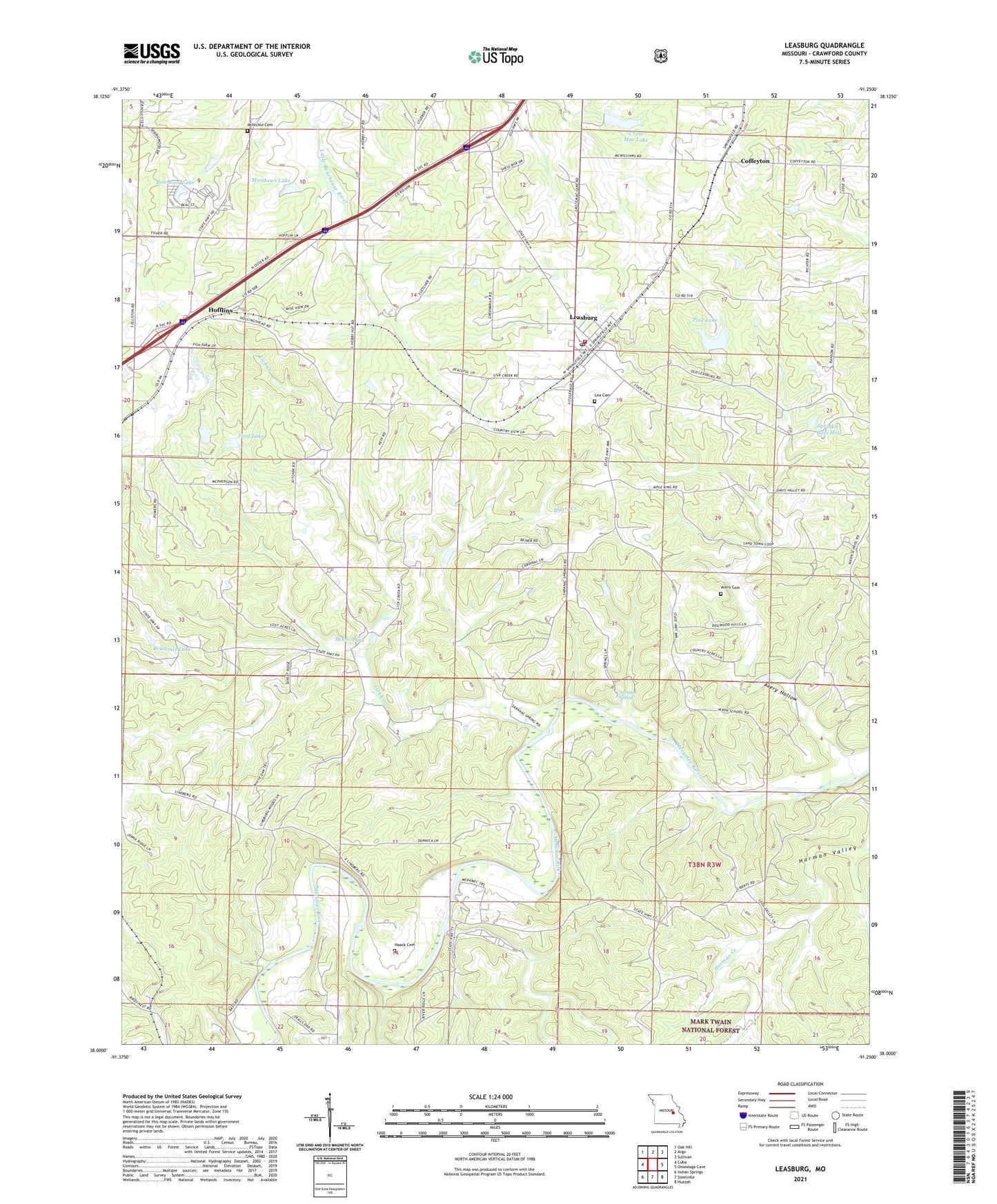
2021 topographic map quadrangle Leasburg in the state of Missouri. Scale: 1:24000. Based on the newly updated USGS 7.5' US Topo map series, this map is in the following counties: Crawford. The map contains contour data, water features, and other items you are used to seeing on USGS maps, but also has updated roads and other features. This is the next generation of topographic maps. Printed on high-quality waterproof paper with UV fade-resistant inks.
Quads adjacent to this one:
West: Cuba
Northwest: Oak Hill
North: Argo
Northeast: Sullivan
East: Onondaga Cave
Southeast: Huzzah
South: Steelville
Southwest: Indian Springs
This map covers the same area as the classic USGS quad with code o38091a3.
Contains the following named places: Avery, Avery Cemetery, Avery Hollow, Blairs Creek, Blue Hole, Boo-Boos Lake, Brummet Lake, Brummet Lake Dam, Budget Buster Dam, Clapps Iron Mine, Coffeyton, Crote Mac Lake, Cuba Fish Farm Dam, Cuba Fish Farm Lake, Ford Lake, Ford Lake Dam, Griffith Iron Mine, Haack Cemetery, Haladale Lake Dam, Harman Valley, Hofflins, Jellystone Park Dam, KBCC-AM (Cuba), Kemp Lake, Kemp Lake Dam, Klontz Lake, Klontz Lake Dam, Landtown, Lea Cemetery, Leasburg, Leasburg Post Office, Leasburg Volunteer Fire Department, Liberty School, Lick Creek, Lick Creek Church, Lick Creek School, Matlock School, Matthews Lake, Matthews Lake Dam, McKee Spring, McNickle Cemetery, Mount Olive Church, Nixon School, Pine Lake, Railroad Iron Mine, Saranac Spring, Sprinkles Bass Hole, Sunnyside School, Township of Benton, Village of Leasburg, Zane Iron Mine, ZIP Code: 65535