MyTopo
Meadville Missouri US Topo Map
Couldn't load pickup availability
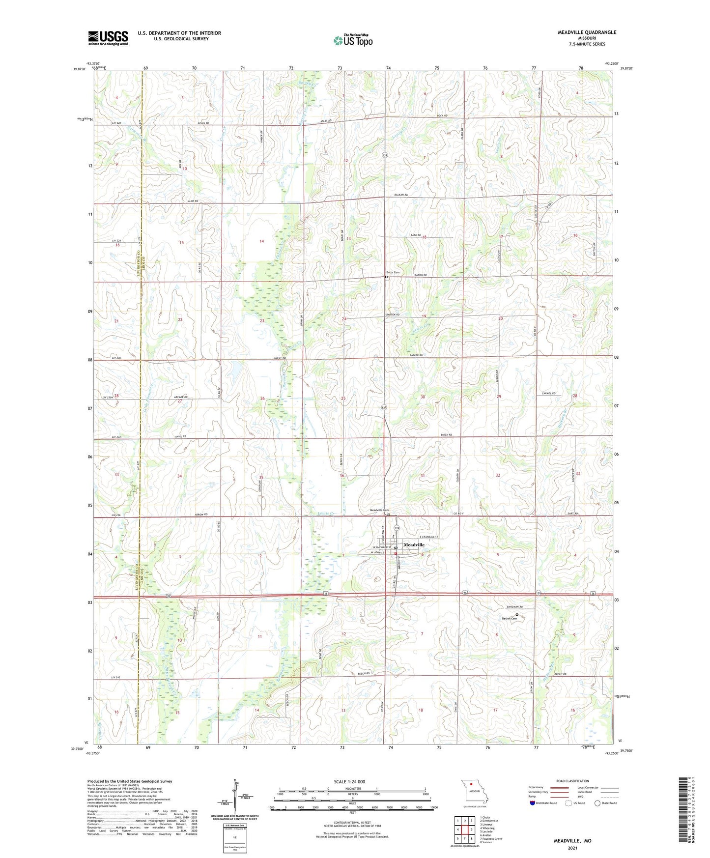
2021 topographic map quadrangle Meadville in the state of Missouri. Scale: 1:24000. Based on the newly updated USGS 7.5' US Topo map series, this map is in the following counties: Linn, Livingston. The map contains contour data, water features, and other items you are used to seeing on USGS maps, but also has updated roads and other features. This is the next generation of topographic maps. Printed on high-quality waterproof paper with UV fade-resistant inks.
Quads adjacent to this one:
West: Wheeling
Northwest: Chula
North: Eversonville
Northeast: Linneus
East: Laclede
Southeast: Sumner
South: Fountain Grove
Southwest: Avalon
This map covers the same area as the classic USGS quad with code o39093g3.
Contains the following named places: Belcher School, Bethel Cemetery, Bethel School, Botts Cemetery, Botts School, Centerview School, City of Meadville, Coon Creek, Duncan School, East Point School, Eureka Church, Eureka School, Fairview School, Lewis Creek, Lousy Creek, Lowell, Lowell Post Office, Meadville, Meadville Cemetery, Meadville Community Fire Department, Meadville Post Office, Patterson Branch, Pleasant Point Church, Pleasant Valley School, Smoky Creek, Township of Clay, Township of Parson Creek, ZIP Code: 64659