MyTopo
Louisiana Missouri US Topo Map
Couldn't load pickup availability
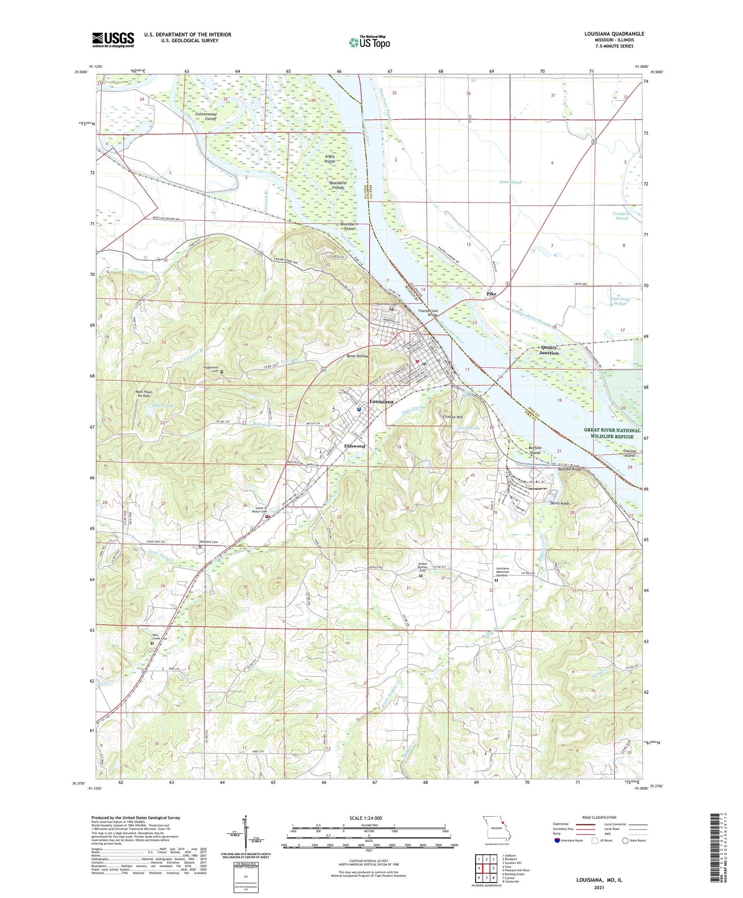
2021 topographic map quadrangle Louisiana in the states of Missouri, Illinois. Scale: 1:24000. Based on the newly updated USGS 7.5' US Topo map series, this map is in the following counties: Pike. The map contains contour data, water features, and other items you are used to seeing on USGS maps, but also has updated roads and other features. This is the next generation of topographic maps. Printed on high-quality waterproof paper with UV fade-resistant inks.
Quads adjacent to this one:
West: Vera
Northwest: Ashburn
North: Rockport
Northeast: Summer Hill
East: Pleasant Hill West
Southeast: Clarksville
South: Cyrene
Southwest: Bowling Green
Contains the following named places: Angle Island, Bethany Cemetery, Bishop Branch, Blackbird Islands, Blackburn Island, Boncl Elementary School, Bone Hollow, Buffalo Church, Buffalo Creek, Buffalo Island, Buffalo Knob, Buffalo School, Buffalo Township Fire Protection District, Champ Clark Bridge, City of Louisiana, Clinton Hill, Clinton Spring, Cocklebur Slough, Cottonwood Cutoff, Davis Knob, Elmwood, Elmwood School, Emmanuel Church, Gates of Peace Cemetery, Gosline Island, Grassy Creek, Henderson School, Hickory Chute, Hickory Grove School, Hoover Field Post Light, Jordan Buffalo Cemetery, KJFM-FM (Louisiana), Lick Valley School, Little Buffalo Creek, Little Noix Creek, Louisana Middle School, Louisiana, Louisiana Elementary School, Louisiana Fire Department, Louisiana High School, Louisiana Memorial Gardens, Louisiana Police Department, Louisiana Post Office, Mark Twain Air Park, Meriwether School, Miller Dam, Miller Lake, Moores, Noix Creek, Noix Creek Cemetery, Noix Creek Church, Oakland School, Pappenfort Cemetery, Pike, Pike County Memorial Hospital, Pike Station Public Access Area, Plum Point Slough, Quincy Junction, Riverside School, Riverview Cemetery, Riverview Park, Salt River, Sand Slough, Sand Slough School, Smith Lake, Smith Lake Dam, Spring Creek, Stark Nursery, Sunset Park, Tanyard Branch, Ted Shanks Wildlife Management Area, Town Branch, Township of Buffalo, Twin Pike Shopping Center, Two Rivers Marina, VFW Park, Whiterock, ZIP Code: 63353