MyTopo
Ashburn Missouri US Topo Map
Couldn't load pickup availability
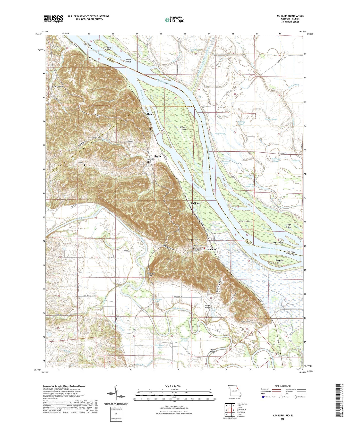
2021 topographic map quadrangle Ashburn in the states of Missouri, Illinois. Scale: 1:24000. Based on the newly updated USGS 7.5' US Topo map series, this map is in the following counties: Pike, Ralls. The map contains contour data, water features, and other items you are used to seeing on USGS maps, but also has updated roads and other features. This is the next generation of topographic maps. Printed on high-quality waterproof paper with UV fade-resistant inks.
Quads adjacent to this one:
West: Hannibal SE
Northwest: Hannibal East
North: Hull
Northeast: Barry
East: Rockport
Southeast: Louisiana
South: Vera
Southwest: Frankford
This map covers the same area as the classic USGS quad with code o39091e2.
Contains the following named places: Ashburn, Ashburn Bridge, Ashburn Cemetery, Ashburn Rural Volunteer Fire Department, Battle Creek, Big Cutoff, Blackbird Island, Blackjack School, Busch, Busch Cemetery, Centenary Cemetery, Centenary School, Cincinnati Landing, Cincinnati School, Clear Lake, Collins Pond Slough, Cronican Slough, Denmark Island, Drift Island, Dupont Reservation Conservation Area, Eagle Island, Early Branch, Early Cemetery, Fools Creek, Gilbert Chute, Gilbert Island, Goose Gap Hollow, Goose Pond, Halfmoon Slough, Happy Hollow, Haw Creek, Haw Creek School, Haw Creek Slough, Hog Slough, Hope, Horn Branch, Horseshoe Lake, Jakes Hollow, Jim Hollow, Jim Young Island, Jolly Cemetery, LaMotte, Love School, Mundy Landing, Old Sugar Creek, Omeys Slough, Pfeiffer School, Pickerton Hill, Riverland, Robison Cemetery, Running Slough, Schindler Cemetery, Shaleton, Stevenson Pond, Swain Slough, Taylor Chapel, Taylor Island, Ted Shanks Conservation Area, Town of Ashburn, Township of Salt River, Vernon School, Walker Airport, ZIP Code: 63433