MyTopo
Manchester Missouri US Topo Map
Couldn't load pickup availability
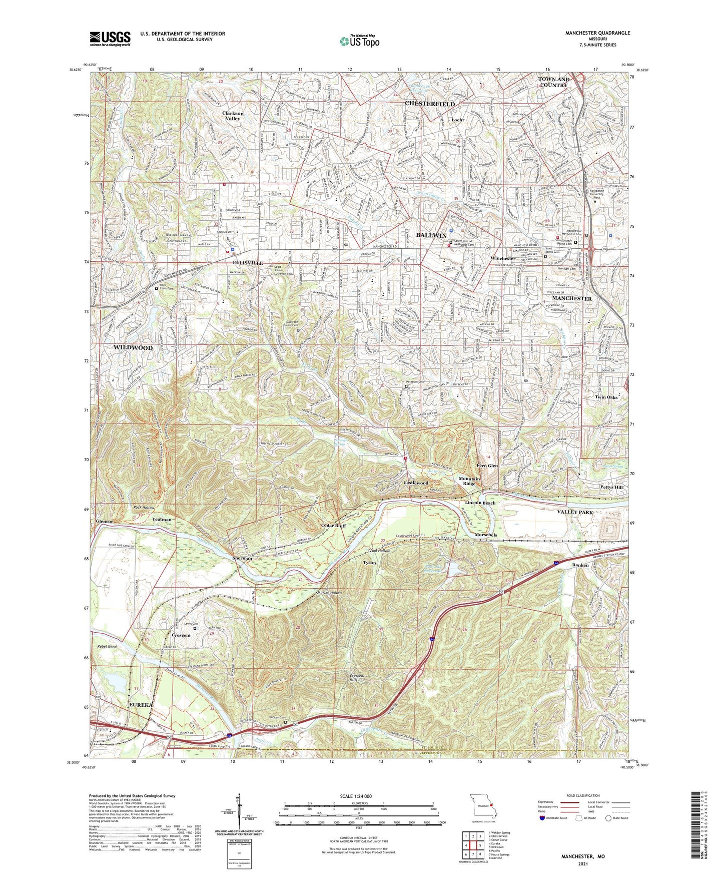
2021 topographic map quadrangle Manchester in the state of Missouri. Scale: 1:24000. Based on the newly updated USGS 7.5' US Topo map series, this map is in the following counties: St. Louis, Jefferson. The map contains contour data, water features, and other items you are used to seeing on USGS maps, but also has updated roads and other features. This is the next generation of topographic maps. Printed on high-quality waterproof paper with UV fade-resistant inks.
Quads adjacent to this one:
West: Eureka
Northwest: Weldon Spring
North: Chesterfield
Northeast: Creve Coeur
East: Kirkwood
Southeast: Maxville
South: House Springs
Southwest: Pacific
This map covers the same area as the classic USGS quad with code o38090e5.
Contains the following named places: Alt School, Antire Creek, Antire Valley County Park, Ballwin, Ballwin Plaza Danny Boy, Ballwin Plaza Shopping Center, Ballwin Police Department, Ballwin Post Office, Castlewood, Castlewood State Park, Cedar Bluff, Center for Creative Learning School, Central County Dispatch Fire and Emergency Services, Central Plaza Shopping Center, Cherry Hill Country Club, City of Ballwin, City of Ellisville, City of Manchester, City of Winchester, Clarkson Plaza, Clarkson Valley, Claymont Elementary School, Claymont Shopping Center, Crescent, Crescent Hills, Crestview Middle School, Dickens Plaza, Ellisville, Ellisville Police Department, Fabick Lake Dam, Fern Glen, Forest Hills Country Club, Glencoe, Grandpas Center Shopping Center, Hamilton Creek, Hanna Woods Elementary School, Henry Elementary School, Jedburgh, Kehrs Mill Elementary School, Kehrs Mill Trails Subdivision Lake C Dam, Keifer Creek, KYMC-FM (Ballwin), Lamp and Lantern Shopping Center, Lewis Cemetery, Lewis Chapel, Lincoln Beach, Little Antire Creek, Loehmanns Plaza, Loehr, Lone Elk County Park, Lone Elk Lower Dam, Lone Elk Reservoir, Lone Elk-Upper Dam, Manchester, Manchester Police Department, Manchester Post Office, Maple Tree Shopping Center, Meadowbrook Country Club, Metro West Fire Protection District Station 1, Metro West Fire Protection District Station 2, Metro West Fire Protection District Station 4, Mincke Hollow, Minke, Morgan Selvidge Middle School, Morschels, Mountain Ridge, Nationalway Shopping Center, Number 126 Reservoir, Onyx Oak Ridge Landfill, Peerless Park Landfill, Peterson Cemetery, Pettys Hill, Pettys Spring, Pierremont Elementary School, Ranken, Ranken Cemetery, Rock Hollow, Rockwood Center Early Child Education Center, Sacred Heart School, Saint Johns Cemetery, Saint Johns Church, Saint Johns School, Schnucks Shopping Center, Sherman, Sontags Spring, Sorrento Springs Elementary School, South High School, Southwest Middle School, Spring Branch, Sturmfels Lake Dam, Sulphur Springs School, Sutton Place, Sutton Place Shopping Center, The Barn at Lucerne Shopping Center, Times Beach, Top Notch Lake Dam, Township of Lafayette, Township of Meramec, Township of Wildhorse, Tyson, Tyson Hollow, Village of Twin Oaks, Village Shopping Center, Washington University Tyson Research Center, West County Emergency Medical Services and Fire Protection District Headquarters, West High School, West Middle School, West Par Golf Course, West Tyson County Park, Williams Creek, Winchester, Woerther Elementary School, Wren Hollow Elementary School, Yeatman, ZIP Codes: 63011, 63021