MyTopo
Mansfield NW Missouri US Topo Map
Couldn't load pickup availability
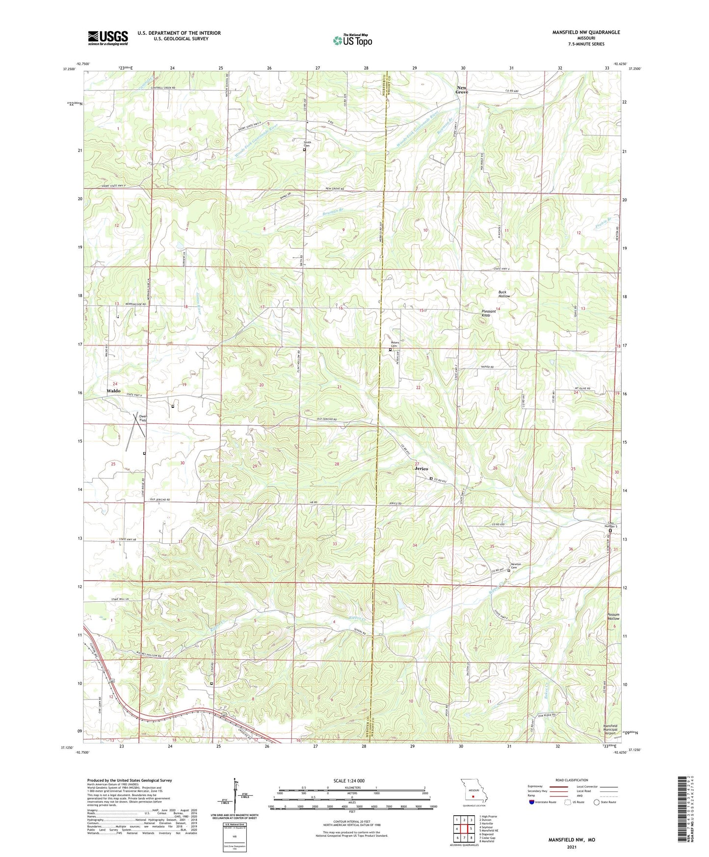
2021 topographic map quadrangle Mansfield NW in the state of Missouri. Scale: 1:24000. Based on the newly updated USGS 7.5' US Topo map series, this map is in the following counties: Webster, Wright. The map contains contour data, water features, and other items you are used to seeing on USGS maps, but also has updated roads and other features. This is the next generation of topographic maps. Printed on high-quality waterproof paper with UV fade-resistant inks.
Quads adjacent to this one:
West: Seymour
Northwest: High Prairie
North: Duncan
Northeast: Hartville
East: Mansfield NE
Southeast: Mansfield
South: Cedar Gap
Southwest: Dogwood
Contains the following named places: Albert Smouse Dam, Antioch Church, Antrim, Antrim Post Office, Bennington, Bethel Church, Bowman Branch, Cemetery Number 5, Crabbs, Flint Hollow School, Jerico, Lone Star Church, Lone Star School, Midway, Mount Olive School, Mountain View School, New Grove, New Grove School, Newton Cemetery, Oak Ridge School, Owen Field, Peters Cemetery, Pleasant Knob, Pleasant Knob School, Pleasant Valley Church, Pleasant Valley School, Rippee Creek, School Number 5, Seymour State Wildlife Management Area, Smith Cemetery Number 01, Sparlin Lake Section 3 Dam, Sparlin Lake Section 35 Dam, Tombleson Church, Township of Hazelwood, Waldo