MyTopo
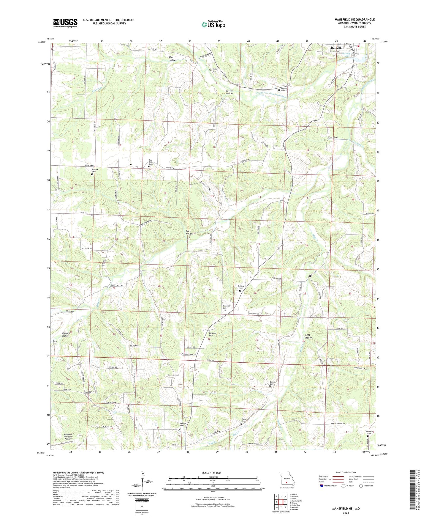
Mansfield NE Missouri US Topo Map
Couldn't load pickup availability
2021 topographic map quadrangle Mansfield NE in the state of Missouri. Scale: 1:24000. Based on the newly updated USGS 7.5' US Topo map series, this map is in the following counties: Wright. The map contains contour data, water features, and other items you are used to seeing on USGS maps, but also has updated roads and other features. This is the next generation of topographic maps. Printed on high-quality waterproof paper with UV fade-resistant inks.
Quads adjacent to this one:
West: Mansfield NW
Northwest: Duncan
North: Hartville
Northeast: Fuson
East: Owens
Southeast: Norwood
South: Mansfield
Southwest: Cedar Gap
This map covers the same area as the classic USGS quad with code o37092b5.
Contains the following named places: Alsop Hollow, Baker Creek, Berry Cemetery, Binkley Cemetery, Boatright Cemetery, Buck Hollow, Campbell Branch, Casador Lake, Casador Lake Dam, Claxton Family Cemetery, Dennis Cemetery, Dennis Church, Dugger Hollow, Elmwood Cemetery, Fagan School, Fry Creek, Hartville Fire and Rescue, Hartville Post Office, Hensley Cemetery, High Point School, Johnson School, Long Hollow, Mansfield Municipal Airport, Matlock Cemetery, Mc Intosh Cemetery, Mission Temple, Newton School, Oetting Cemetery, Oetting Church, Oetting School, Pea Ridge Cemetery, Pea Ridge Church, Pea Ridge School, Pleasant Hope Church, Possum Hollow, Prairie Branch, Quillen Branch, Rembert, Rembert Post Office, Spence Creek, Township of Gasconade, Turner Cemetery, Umpire, Umpire Post Office, Wolf Creek, Wolf Creek Church, ZIP Code: 65704