MyTopo
Maples Missouri US Topo Map
Couldn't load pickup availability
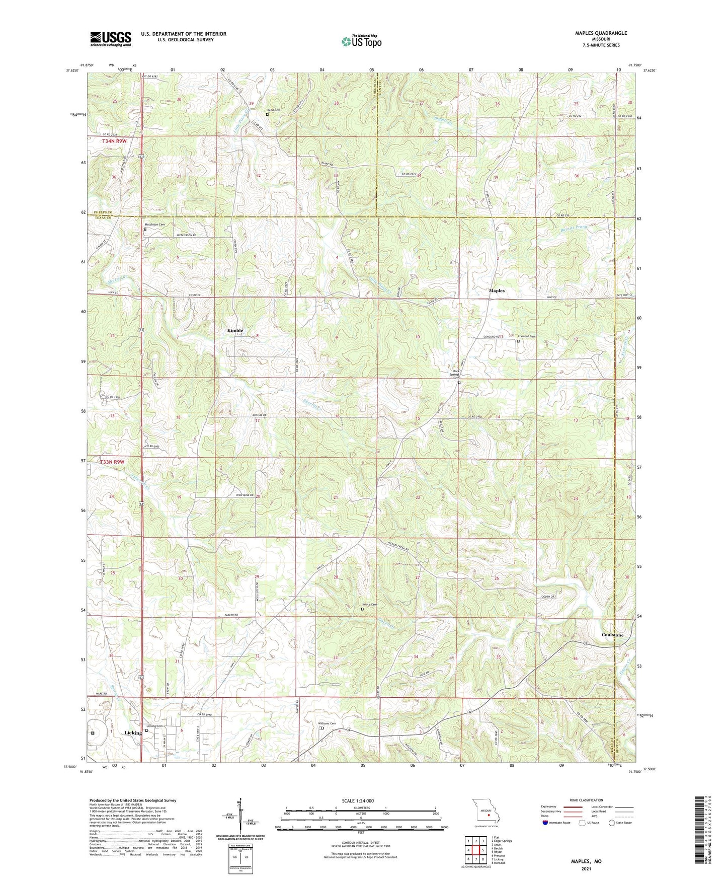
2021 topographic map quadrangle Maples in the state of Missouri. Scale: 1:24000. Based on the newly updated USGS 7.5' US Topo map series, this map is in the following counties: Texas, Dent, Phelps. The map contains contour data, water features, and other items you are used to seeing on USGS maps, but also has updated roads and other features. This is the next generation of topographic maps. Printed on high-quality waterproof paper with UV fade-resistant inks.
Quads adjacent to this one:
West: Beulah
Northwest: Flat
North: Edgar Springs
Northeast: Anutt
East: Rhyse
Southeast: Montauk
South: Licking
Southwest: Prescott
Contains the following named places: Baxter School, Bethel Church, Bethel School, Concord Baptist Church, Concord Cemetery, Concord School, Coulstone, Crow Church, Crow School, Gospel Chapel, Hutchison Cemetery, Kimble, Maples, New Salem Church, Old Crow Camp Ground, Pigeon Creek School, Pine Church, Reed Cemetery, Rock Spring Church, South Central Correctional Center, Stoney Point School, Township of Sherrill, White Cemetery, Williams Cemetery