MyTopo
Martinsburg Missouri US Topo Map
Couldn't load pickup availability
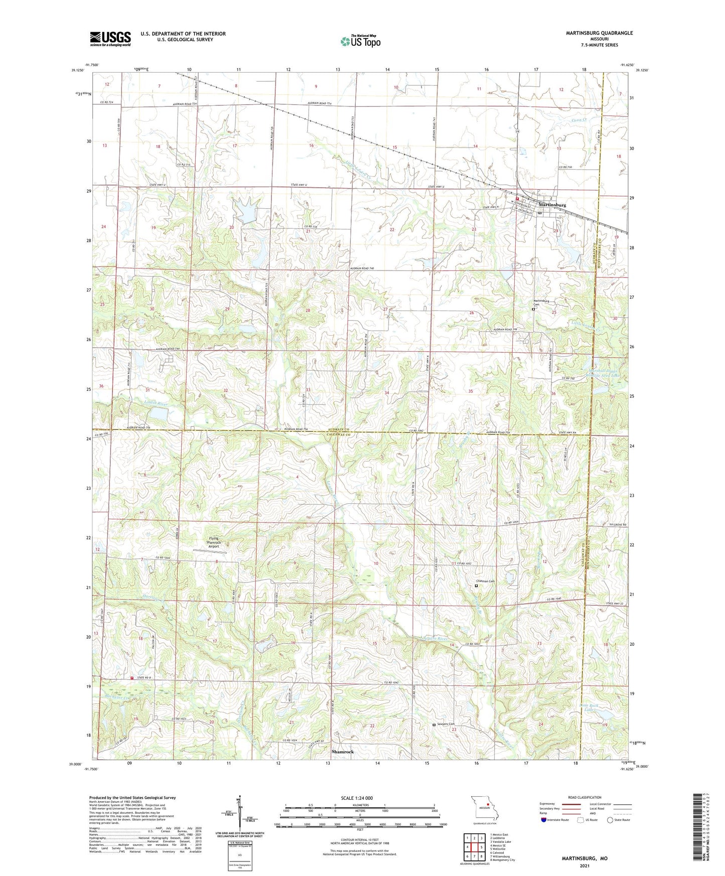
2021 topographic map quadrangle Martinsburg in the state of Missouri. Scale: 1:24000. Based on the newly updated USGS 7.5' US Topo map series, this map is in the following counties: Audrain, Callaway, Montgomery. The map contains contour data, water features, and other items you are used to seeing on USGS maps, but also has updated roads and other features. This is the next generation of topographic maps. Printed on high-quality waterproof paper with UV fade-resistant inks.
Quads adjacent to this one:
West: Mexico SE
Northwest: Mexico East
North: Laddonia
Northeast: Vandalia Lake
East: Wellsville
Southeast: Montgomery City
South: Williamsburg
Southwest: Calwood
Contains the following named places: Brown Lake Dam, Brushy Branch, Chapel Grove School, Chatman Cemetery, Covington Lake Dam, Crane School, Fair Oak School, Flying Shamrock Airport, Harrison Creek, Hazel Dell School, Liberty Church, Lone Rock Lake, Lone Rock Lake Dam, Marshall Diggs Wildlife Area Dam - North, Marshall Diggs Wildlife Area Lake, Marshall I Diggs State Wildlife Management A, Marshell Diggs Wildlife Area South Dam, Martinsburg, Martinsburg Area Fire Protection District, Martinsburg Cemetery, Martinsburg Post Office, Morris Branch, Norfolk Lake Dam, North Callaway Fire Protection District Station 6, Sawyers Cemetery, Shamrock, Shamrock School, South Liberty School, Town of Martinsburg, Township of Loutre, Township of Shamrock, Venice, Welshmeyer Lake Dam, Wieburg Lake Dam, Zander Lake Dam, ZIP Code: 65264