MyTopo
Maryville West Missouri US Topo Map
Couldn't load pickup availability
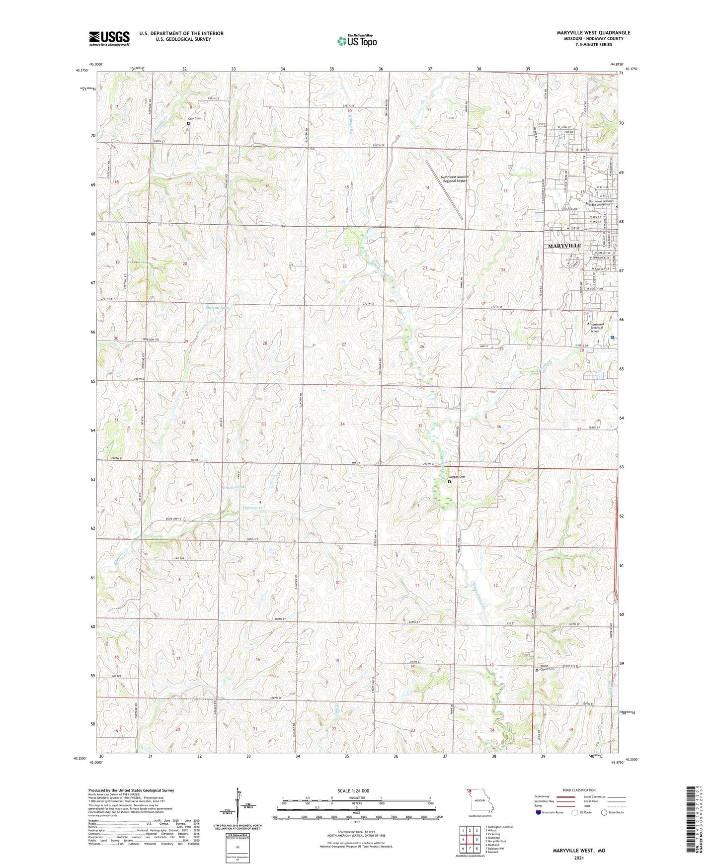
2021 topographic map quadrangle Maryville West in the state of Missouri. Scale: 1:24000. Based on the newly updated USGS 7.5' US Topo map series, this map is in the following counties: Nodaway. The map contains contour data, water features, and other items you are used to seeing on USGS maps, but also has updated roads and other features. This is the next generation of topographic maps. Printed on high-quality waterproof paper with UV fade-resistant inks.
Quads adjacent to this one:
West: Skidmore
Northwest: Burlington Junction
North: Wilcox
Northeast: Pickering
East: Maryville East
Southeast: Barnard
South: Bolckow NW
Southwest: Maitland
Contains the following named places: Area Cooperative for Education Support, Bell Grove, Bell Grove School, Big Slough, Cain Cemetery, East Star School, Gill School, Highland School, Horace Mann Laboratory School, Houston Lake, Houston Lake Dam, Knabb School, KNIM-AM (Maryville), KNIM-FM (Maryville), KXCV-FM (Maryville), Lasher School, Maryville High School, Maryville Middle School, Morgan Cemetery, Nodaway County, Nodaway County Farm, Northwest Missouri Regional Airport, Northwest Missouri State University, Northwest Technical School, Peace and Harmony School, Peach Creek, Pleasant Hill School, Rockford School, Scudder School, Shelton Lake, Shelton Lake Dam, SSM Health Saint Francis Hospital - Maryville, Swallow School, White Cloud Cemetery, ZIP Code: 64468