MyTopo
Pickering Missouri US Topo Map
Couldn't load pickup availability
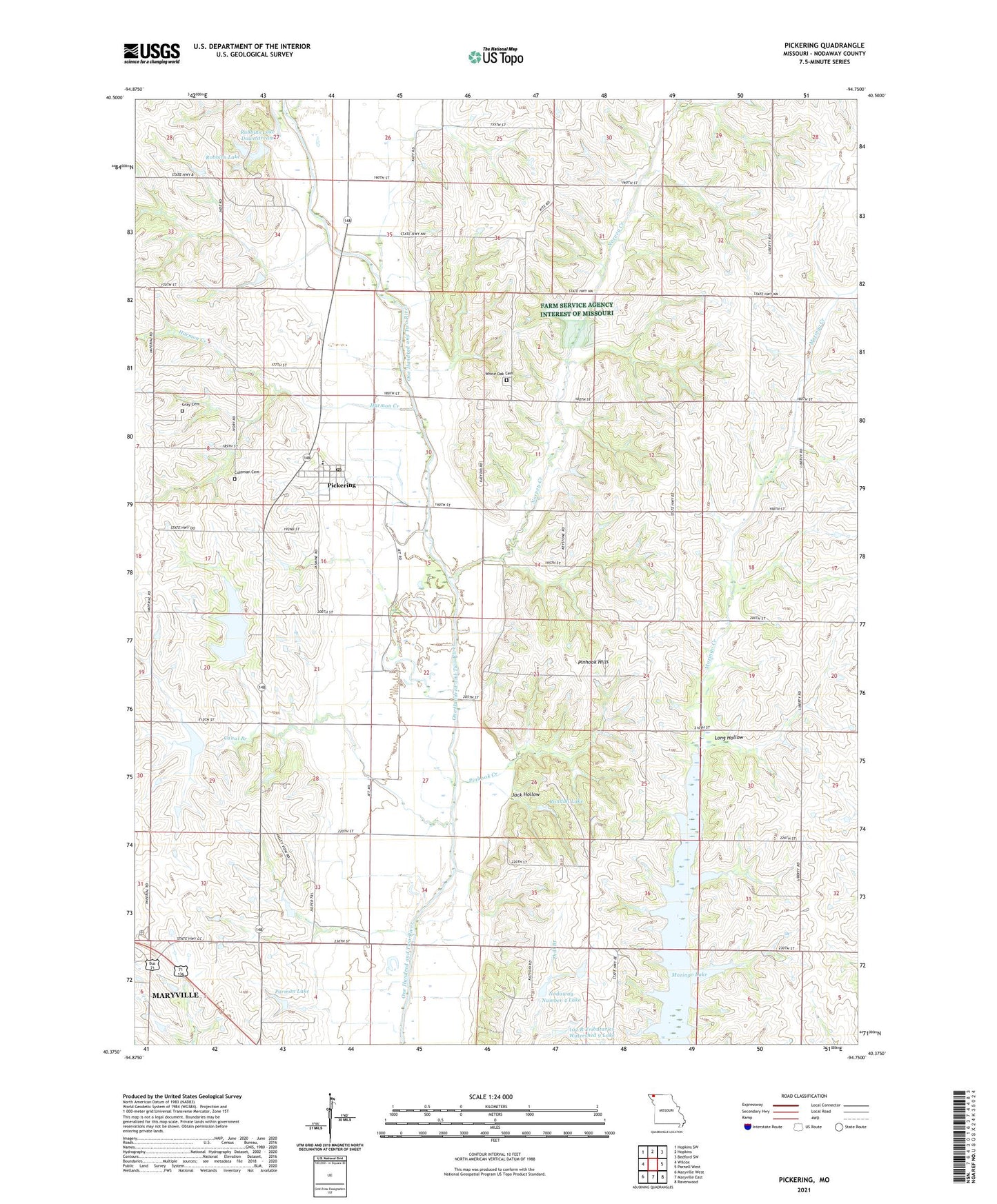
2021 topographic map quadrangle Pickering in the state of Missouri. Scale: 1:24000. Based on the newly updated USGS 7.5' US Topo map series, this map is in the following counties: Nodaway. The map contains contour data, water features, and other items you are used to seeing on USGS maps, but also has updated roads and other features. This is the next generation of topographic maps. Printed on high-quality waterproof paper with UV fade-resistant inks.
Quads adjacent to this one:
West: Wilcox
Northwest: Hopkins SW
North: Hopkins
Northeast: Bedford SW
East: Parnell West
Southeast: Ravenwood
South: Maryville East
Southwest: Maryville West
This map covers the same area as the classic USGS quad with code o40094d7.
Contains the following named places: 102 River Tributaries Watershed 9 Dam, 102 River Tributaries Watershed 9 Lake, 102 River Tributaries Watershed Dam C-5, 102 River Tributaries Watershed Number 12 Dam, 102 River Tributaries Watershed Number 4 Dam, 102 River Tributaries Watershed Structure LT-36 Dam, 64476, Bloomdale School, Bloomfield School, Canal Branch, Coleman Cemetery, Excelsior School, Ezcelsior School, Glendale School, Gray Cemetery, Happy Hollow School, Harmon Creek, Jack Hollow, Long Hollow, Mount Pleasant School, Mowery School, Mozingo Valley School, Myrtle Tree School, Nodaway County Community Lake, Nodaway Lake Dam, Nodaway Number 4 Lake, North Nodaway Elementary School, Norvey Creek, Parman Lake, Parman Lake Dam, Pickering, Pickering Post Office, Pinhook Creek, Pinhook Hills, Randall Lake, Robbins Lake, Robbins Lake Dam, Robbins Lake Dam Downstream, Robbins Lake Downstream, Slaughter Branch, Town of Pickering, Township of Union, Union School, White Oak Cemetery, Wilson Lake Dam, Xenia School