MyTopo
Barnard Missouri US Topo Map
Couldn't load pickup availability
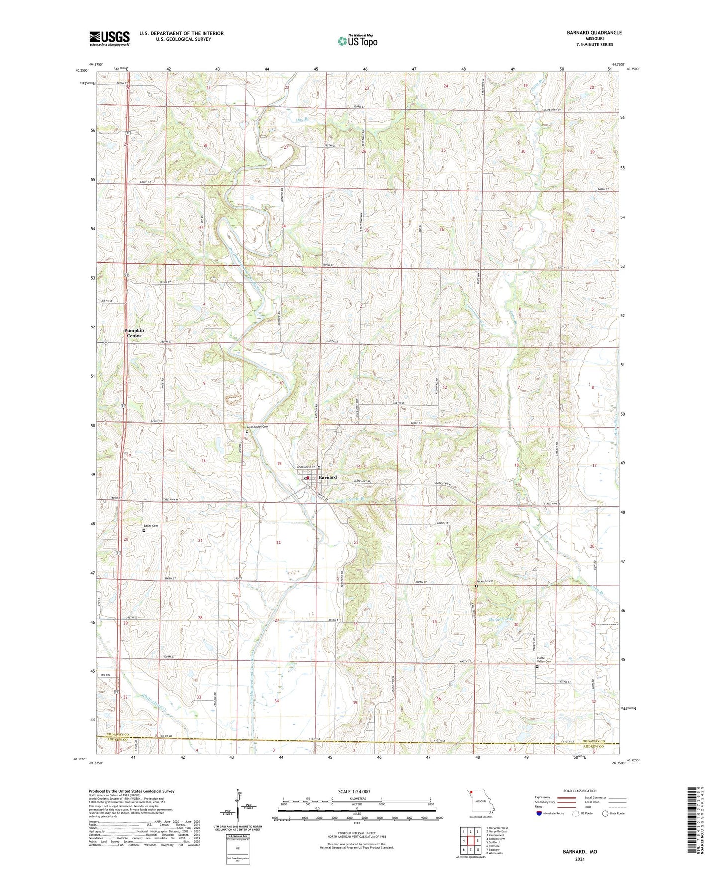
2021 topographic map quadrangle Barnard in the state of Missouri. Scale: 1:24000. Based on the newly updated USGS 7.5' US Topo map series, this map is in the following counties: Nodaway, Andrew. The map contains contour data, water features, and other items you are used to seeing on USGS maps, but also has updated roads and other features. This is the next generation of topographic maps. Printed on high-quality waterproof paper with UV fade-resistant inks.
Quads adjacent to this one:
West: Bolckow NW
Northwest: Maryville West
North: Maryville East
Northeast: Ravenwood
East: Guilford
Southeast: Whitesville
South: Bolckow
Southwest: Fillmore
This map covers the same area as the classic USGS quad with code o40094b7.
Contains the following named places: Alumbaugh Cemetery, Baker Cemetery, Barnard, Barnard Fire Protection District Station 1 Headquarters, Barnard Post Office, Black Oak Public Access, Blackoak School, Central School, City of Barnard, Cottonwood Creek, Dog Branch, Dougan School, Fairview School, Fox School, Hannah Lake, Hannah Lake Dam, Harmon School, Jackson Cemetery, Liberty School, Mount Joy School, Platte Valley Cemetery, Pumpkin Center, Salem Church, Skidmore School, South Nodaway High School, Township of Grant, White Hall School, ZIP Code: 64423