MyTopo
Bunker Missouri US Topo Map
Couldn't load pickup availability
Also explore the Bunker Forest Service Topo of this same quad for updated USFS data
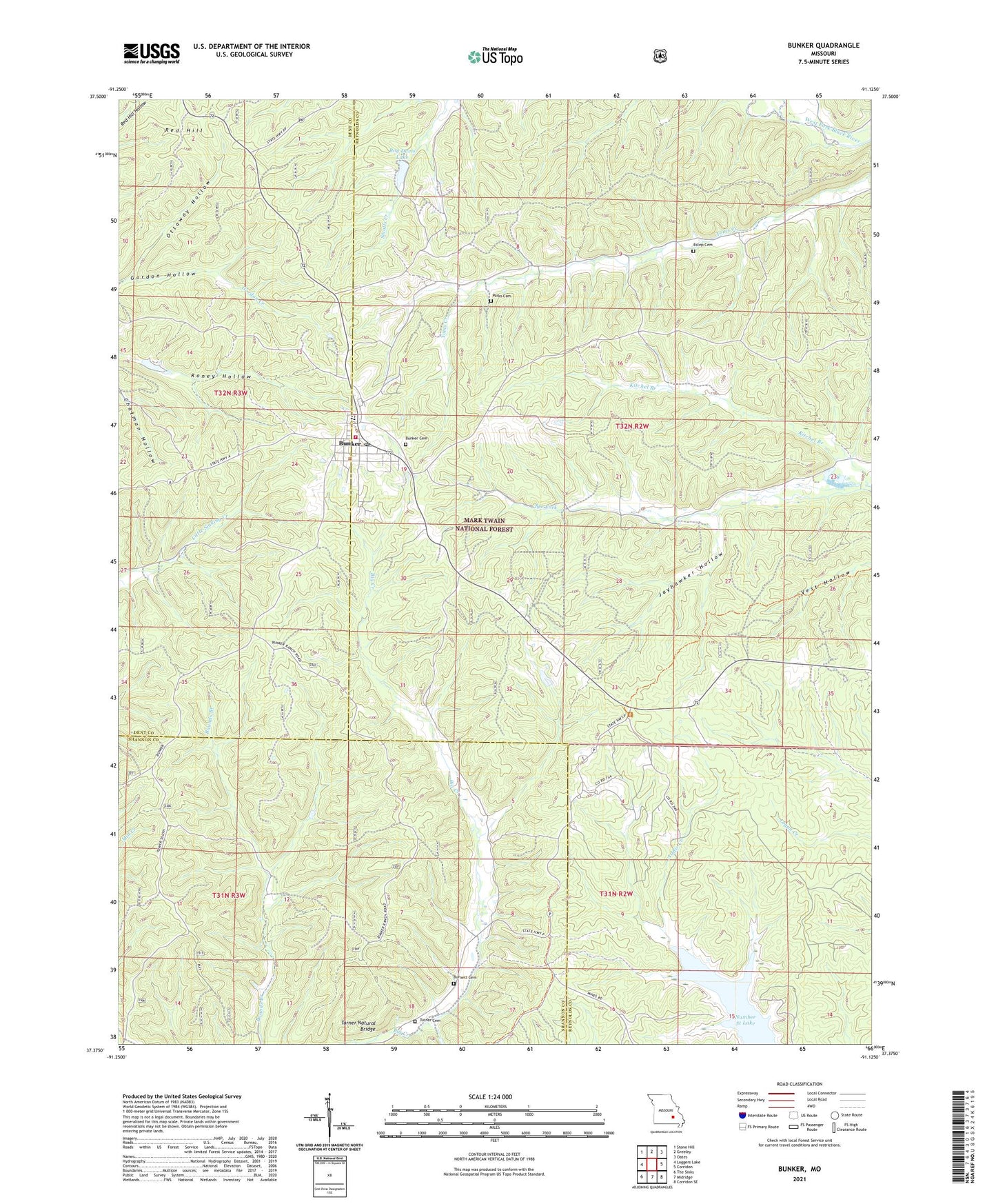
2021 topographic map quadrangle Bunker in the state of Missouri. Scale: 1:24000. Based on the newly updated USGS 7.5' US Topo map series, this map is in the following counties: Reynolds, Dent, Shannon. The map contains contour data, water features, and other items you are used to seeing on USGS maps, but also has updated roads and other features. This is the next generation of topographic maps. Printed on high-quality waterproof paper with UV fade-resistant inks.
Quads adjacent to this one:
West: Loggers Lake
Northwest: Stone Hill
North: Greeley
Northeast: Oates
East: Corridon
Southeast: Corridon SE
South: Midridge
Southwest: The Sinks
This map covers the same area as the classic USGS quad with code o37091d2.
Contains the following named places: Bills Creek, Black Hill School, Bunker, Bunker Cemetery, Bunker Lookout Tower, Bunker Volunteer Fire Department, Christ the King Church, City of Bunker, Estep Cemetery, Jayhawker Hollow, Lily Farm, Little Vine Church, Melton, Number 51 Lake, Oak Grove, Ottaway Hollow, Parks Cemetery, Red Hill, Roy Davis Dam, Roy Davis Lake, Turner Cemetery, Turner Natural Bridge, West Bunker, ZIP Code: 63629