MyTopo
Mincy Missouri US Topo Map
Couldn't load pickup availability
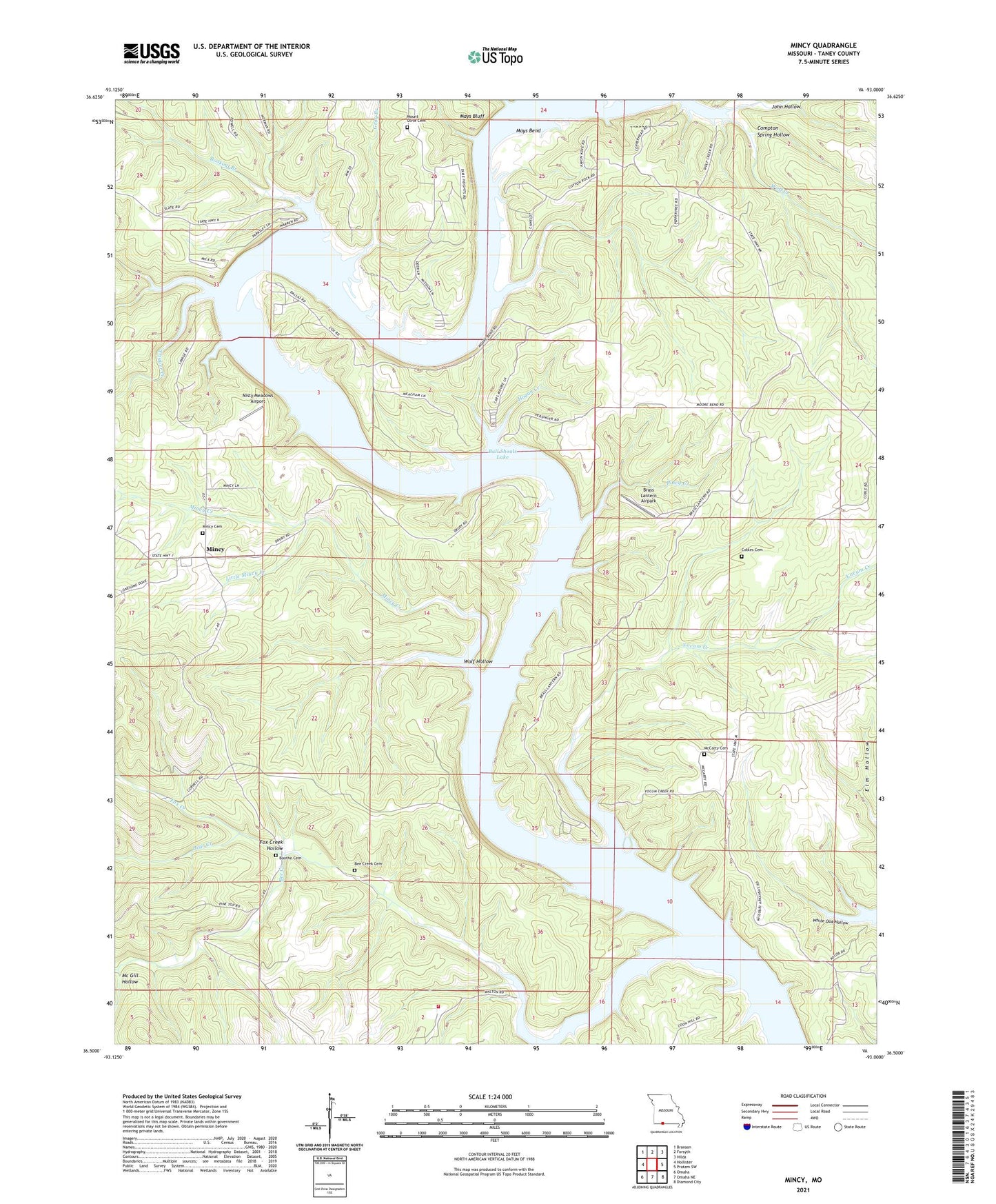
2021 topographic map quadrangle Mincy in the state of Missouri. Scale: 1:24000. Based on the newly updated USGS 7.5' US Topo map series, this map is in the following counties: Taney. The map contains contour data, water features, and other items you are used to seeing on USGS maps, but also has updated roads and other features. This is the next generation of topographic maps. Printed on high-quality waterproof paper with UV fade-resistant inks.
Quads adjacent to this one:
West: Hollister
Northwest: Branson
North: Forsyth
Northeast: Hilda
East: Protem SW
Southeast: Diamond City
South: Omaha NE
Southwest: Omaha
Contains the following named places: Bald Knob Church, Bald Knob School, Bear Creek, Bee Creek, Bee Creek Cemetery, Bee Creek School South, Bill Youngs Camp, Bookout Branch, Boothe Cemetery, Brass Lantern Airpark, Cedar Creek, Cedar Creek Volunteer Fire Department Station 2, Cedar Creek Volunteer Fire Department Station 3, Cobles Cemetery, Compton Spring Hollow, Drury Refuge, Fox Creek, Fox Creek Hollow, Glory School, Gray Branch, Hogan Creek, John Hollow, Little Mincy Creek, Mays Bend, Mays Bluff, Mc Gill Hollow, McCarty Church, McGill Hollow, Mincy, Mincy Cemetery, Mincy Creek, Mincy Public Hunting Area, Mincy School, Misty Meadows Airport, Moores Ferry, Mount Olive Church, Piney Creek, Saint Louis Game Park, Township of Cedar Creek, Trigger Creek, Western Taney County Fire Protection District Station 11, White Oak School, Wolf Hollow, Woodard Launching Area, Yocum Creek, ZIP Codes: 65627, 65679