MyTopo
Omaha Arkansas US Topo Map
Couldn't load pickup availability
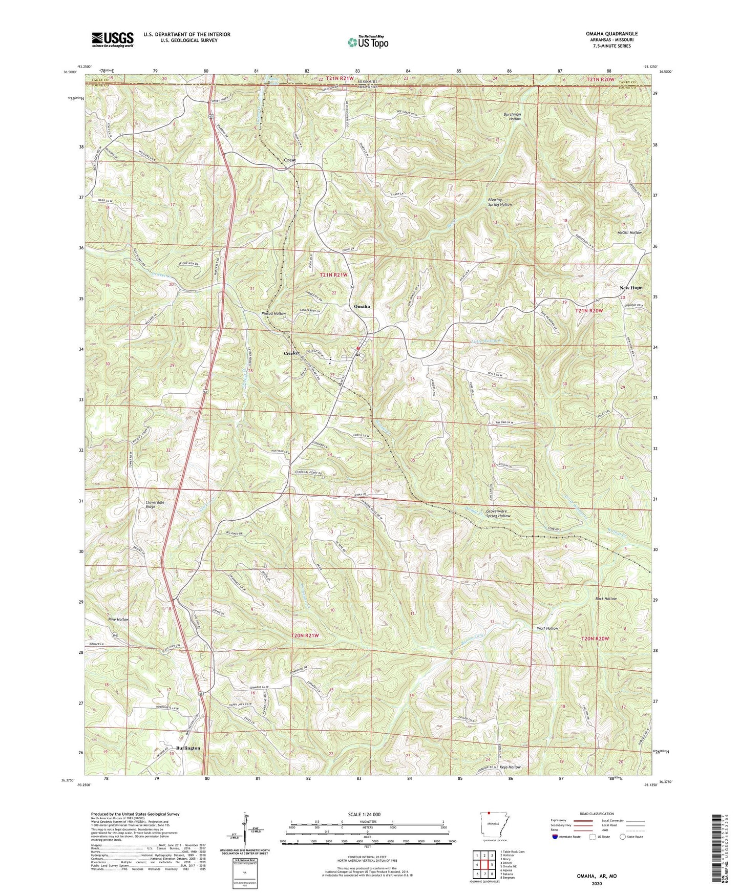
2024 topographic map quadrangle Omaha in the states of Arkansas, Missouri. Scale: 1:24000. Based on the newly updated USGS 7.5' US Topo map series, this map is in the following counties: Boone, Taney. The map contains contour data, water features, and other items you are used to seeing on USGS maps, but also has updated roads and other features. This is the next generation of topographic maps. Printed on high-quality waterproof paper with UV fade-resistant inks.
Quads adjacent to this one:
West: Denver
Northwest: Table Rock Dam
North: Hollister
Northeast: Mincy
East: Omaha NE
Southeast: Bergman
South: Batavia
Southwest: Alpena
Contains the following named places: Blowing Spring Hollow, Buck Hollow, Burchman Hollow, Burlington, Burlington Baptist Church, Burlington Lookout Tower, Cloverdale Ridge, Cranenest Creek, Crest, Cricket, Groverware Spring Hollow, KHOZ-FM (Harrison), Little Walnut Creek, New Hope, New Hope Baptist Church, Omaha, Omaha Church of Christ, Omaha Elementary School, Omaha Fire Department, Omaha High School, Omaha Middle School, Omaha Post Office, Pinrod Hollow, Shaw Lake, Shaw Lake Dam, Town of Omaha, Township of Long Creek, Township of Omaha, Walnut Creek, Wolf Hollow, ZIP Code: 72662