MyTopo
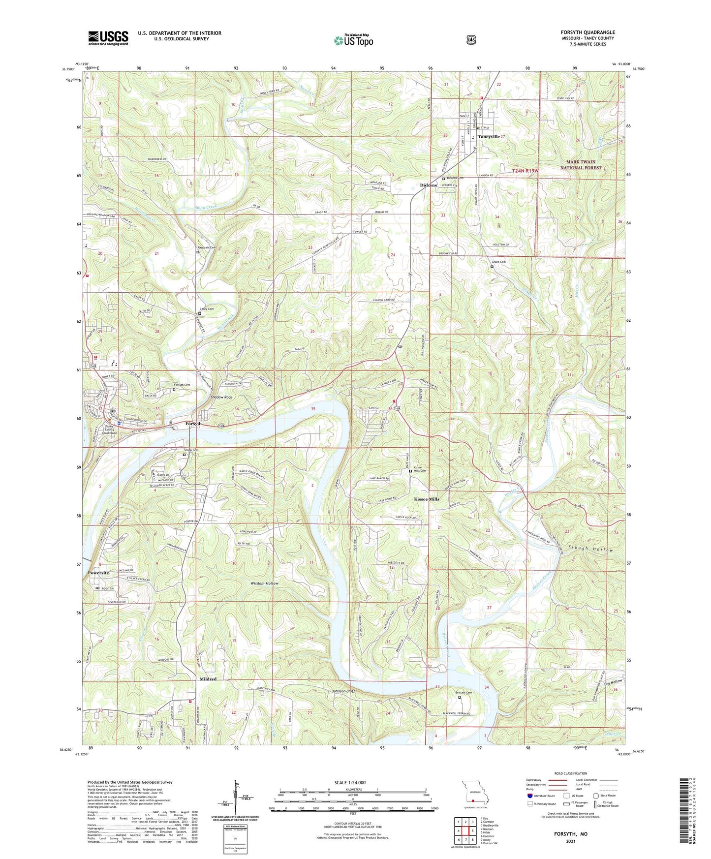
Forsyth Missouri US Topo Map
Couldn't load pickup availability
Also explore the Forsyth Forest Service Topo of this same quad for updated USFS data
2021 topographic map quadrangle Forsyth in the state of Missouri. Scale: 1:24000. Based on the newly updated USGS 7.5' US Topo map series, this map is in the following counties: Taney. The map contains contour data, water features, and other items you are used to seeing on USGS maps, but also has updated roads and other features. This is the next generation of topographic maps. Printed on high-quality waterproof paper with UV fade-resistant inks.
Quads adjacent to this one:
West: Branson
Northwest: Day
North: Garrison
Northeast: Bradleyville
East: Hilda
Southeast: Protem SW
South: Mincy
Southwest: Hollister
This map covers the same area as the classic USGS quad with code o36093f1.
Contains the following named places: Beaver Creek, Beaver Creek Public Use Area, Brittain Cemetery, Casey Cemetery, Cedar Grove School, Central Taney County Fire Protection District Station 1, Central Taney County Fire Protection District Station 2, Central Taney County Fire Protection District Station 4, Central Taney County Fire Protection District Station 5, City of Forsyth, City of Forsyth Fire Department, Cold Spring Camp, Dickens, Dickens Cemetery, Dry Hollow, Electric Park, Faith Assembly of God Church, Forsyth, Forsyth Cemetery, Forsyth Church of God, Forsyth Police Department, Forsyth Post Office, Forsyth Public Schools, Forsyth United Methodist Church, Grant Cemetery, Houseman Creek, Johnson Bluff, Kissee Mills, Kissee Mills Cemetery, Kissee Mills Census Designated Place, Kissee Mills Church, Kissee Mills Post Office, Kissee Mills Public Use Area, Kissee Mills School, Max Creek, McFarland, Mildred, New Vision Church, Pleasant Hill Church, Powersite, Powersite Dam, Powersite Post Office, Ragsdale Cemetery, River Run Public Use Area, River View Bible Baptists Church, Shadow Rock, Shadow Rock Public Use Area, Shadowrock Park, Shepherd of the Hills Estates, Silver Creek, Slough Hollow, Snapp Cemetery, Stout Creek, Swan Creek, Taney County, Taney County Sheriff's Office, Taneycomo Country Club, Taneyville, Taneyville Post Office, Taneyville School, Taneyville Union Chapel, Township of Swan, Village of Taneyville, White River Association Church Camp, White River Camp, White Swan Camp, Wilson School, Winkle Creek, Wisdom Hollow, Wolf Creek, ZIP Code: 65680