MyTopo
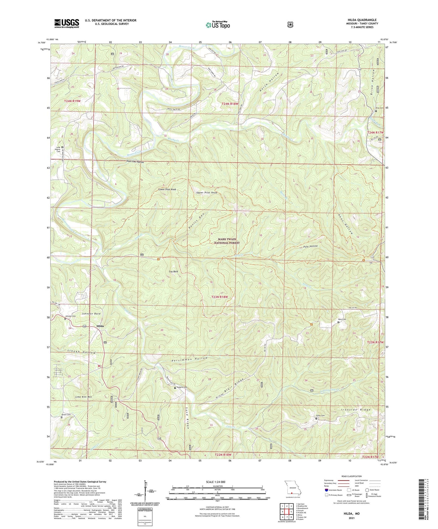
Hilda Missouri US Topo Map
Couldn't load pickup availability
Also explore the Hilda Forest Service Topo of this same quad for updated USFS data
2021 topographic map quadrangle Hilda in the state of Missouri. Scale: 1:24000. Based on the newly updated USGS 7.5' US Topo map series, this map is in the following counties: Taney. The map contains contour data, water features, and other items you are used to seeing on USGS maps, but also has updated roads and other features. This is the next generation of topographic maps. Printed on high-quality waterproof paper with UV fade-resistant inks.
Quads adjacent to this one:
West: Forsyth
Northwest: Garrison
North: Bradleyville
Northeast: Brownbranch
East: Protem NE
Southeast: Protem
South: Protem SW
Southwest: Mincy
This map covers the same area as the classic USGS quad with code o36092f8.
Contains the following named places: Blair Cemetery, Blair Ridge, Bray Cemetery, Brink Hollow, Brown Cemetery, Brown School, Brushy Creek, Bryant School, Cane Creek, Central Taney County Fire Protection District Station 3, Chapel of the Ozarks, Coy Bald, Devils Den, Edley Cemetery, Hercules Lookout Tower, Hercules-Glades Wilderness, Hilda, Hilda Lookout Tower, Hoot Owl Hollow, Jody, Johnson Bald, Johnson Cemetery, Johnson School, Lone Pilgrim Cemetery, Long Creek, Lower Pilot Knob, Mopping Branch, Mores Branch, New Machion Church, North Hollow, North Prong Cane Creek, Pees Hollow, Persimmon Hollow, Pole Hollow, Roberts Cemetery, Sand Ridge, Township of Beaver, Upper Pilot Knob