MyTopo
Mokane East Missouri US Topo Map
Couldn't load pickup availability
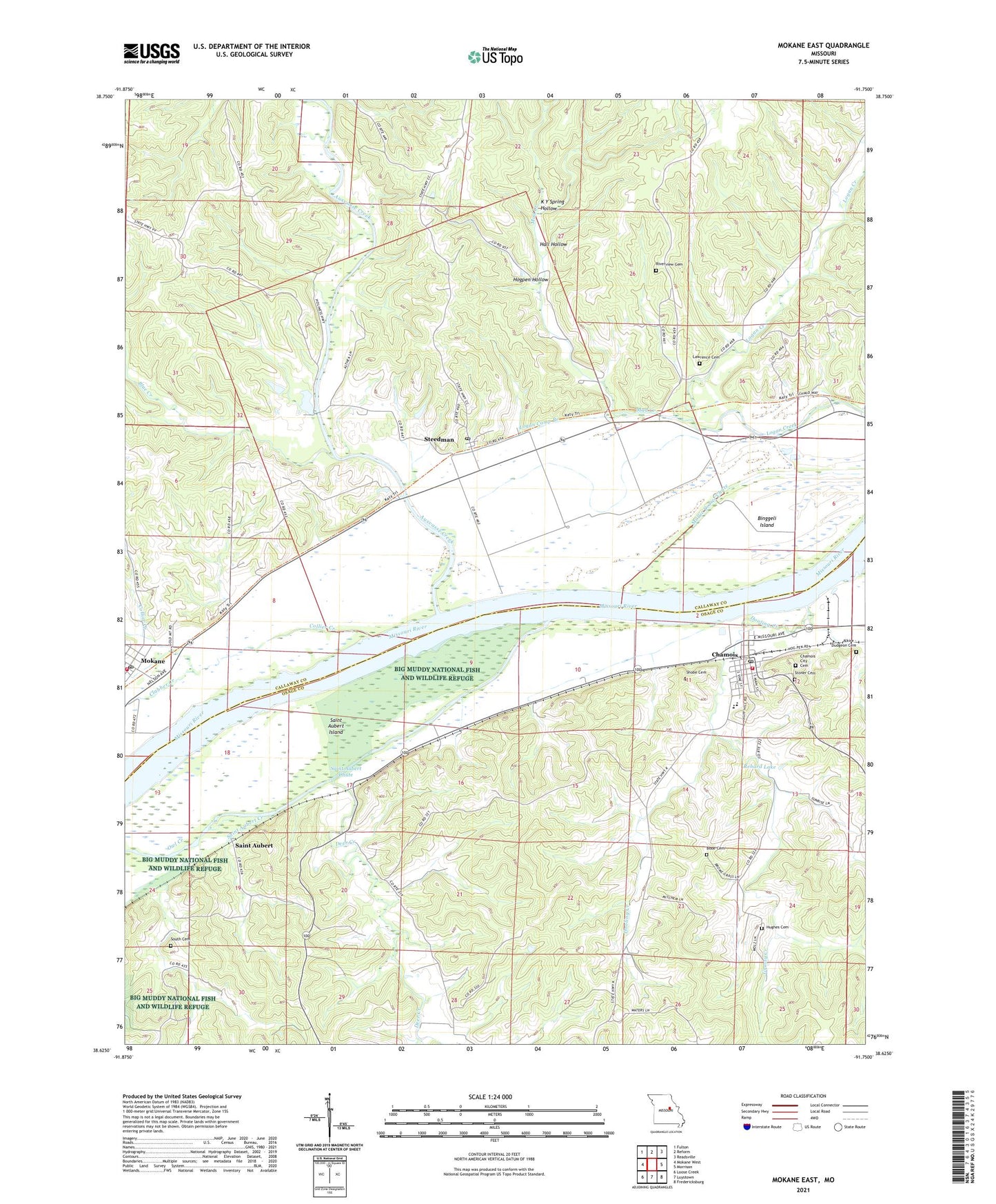
2021 topographic map quadrangle Mokane East in the state of Missouri. Scale: 1:24000. Based on the newly updated USGS 7.5' US Topo map series, this map is in the following counties: Callaway, Osage. The map contains contour data, water features, and other items you are used to seeing on USGS maps, but also has updated roads and other features. This is the next generation of topographic maps. Printed on high-quality waterproof paper with UV fade-resistant inks.
Quads adjacent to this one:
West: Mokane West
Northwest: Fulton
North: Reform
Northeast: Readsville
East: Morrison
Southeast: Fredericksburg
South: Luystown
Southwest: Loose Creek
Contains the following named places: Acorn School, Auxvasse Creek, Binggeli Island, Blackburn School, Blue Creek, Bode Cemetery, Bode School, Chamois, Chamois City Cemetery, Chamois Post Office, Chamois Volunteer Fire Department, City of Chamois, City of Mokane, Clabber Creek, Collier Creek, Cottonrock School, Deer Creek, Dooling Creek, East Wing Creek, Evangical Church, Glavin School, Grassy Creek, Hall Hollow, Hogpen Hollow, Hughes Cemetery, K Y Spring Hollow, Lawrence Cemetery, Lawrence School, Logan Camp Branch, Miller Lake Dam, Mokane, Mokane Post Office, Mud Creek, Owl Creek, Reform Church, Rehard Lake, Riverview Church, Saint Aubert, Saint Aubert Chute, Saint Aubert Creek, Saint Aubert Island, Saint Aubert School, Saint Johannes German Lutheran Church, Saint Marys Catholic Church, Shobe Cemetery, South Callaway Fire Protection District Station 1, South Cemetery, Steedman, Steedman Post Office, ZIP Code: 65059