MyTopo
Florida Missouri US Topo Map
Couldn't load pickup availability
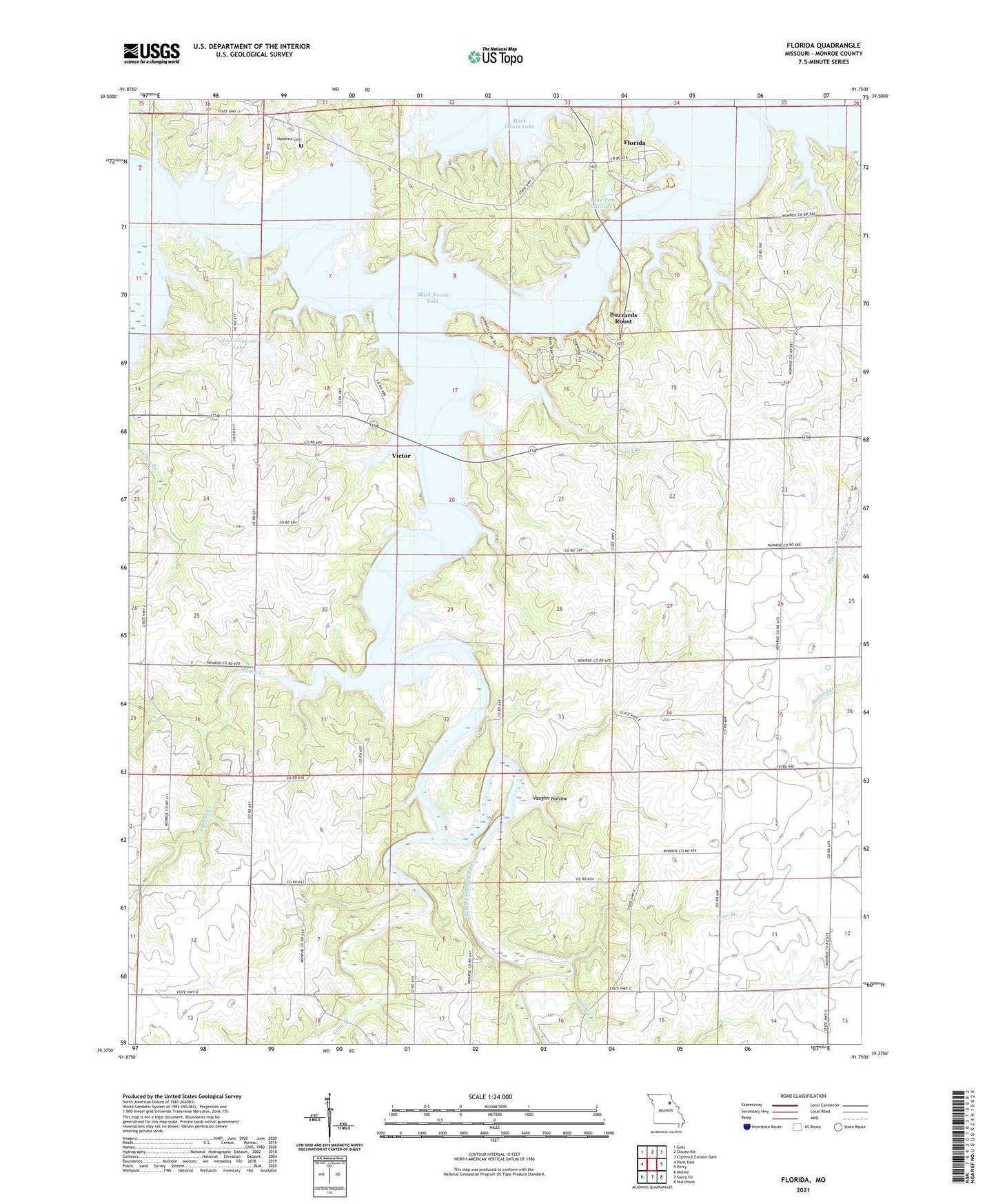
2021 topographic map quadrangle Florida in the state of Missouri. Scale: 1:24000. Based on the newly updated USGS 7.5' US Topo map series, this map is in the following counties: Monroe. The map contains contour data, water features, and other items you are used to seeing on USGS maps, but also has updated roads and other features. This is the next generation of topographic maps. Printed on high-quality waterproof paper with UV fade-resistant inks.
Quads adjacent to this one:
West: Paris East
Northwest: Goss
North: Stoutsville
Northeast: Clarence Cannon Dam
East: Perry
Southeast: Hutchison
South: Santa Fe
Southwest: Molino
This map covers the same area as the classic USGS quad with code o39091d7.
Contains the following named places: Bear Branch, Bergthold Dam, Bonsall School, Brush Creek, Buzzards Roost, Carr Branch, Casey College School, Dashner School, Florida, Hawkins Cemetery, Ivy Branch, Jack Simpson Dam, Jack Simpson Lake, Jordan Branch, Lake Tom Sawyer, Lake Tom Sawyer Dam, Long Branch, Mark Twain Birthplace State Historic Site, Mark Twain State Park, Peak School, Poage School, Simpson Farms Lake Dam, Smiley Branch, South Brush Creek, South Fork Church, South Fork Recreation Area, South Fork Salt River, South Fork School, Township of Jefferson, Township of South Fork, Vaughn Hollow, Victor, Victor Church, Victor School, Village of Florida, ZIP Code: 65282