MyTopo
Nelsonville Missouri US Topo Map
Couldn't load pickup availability
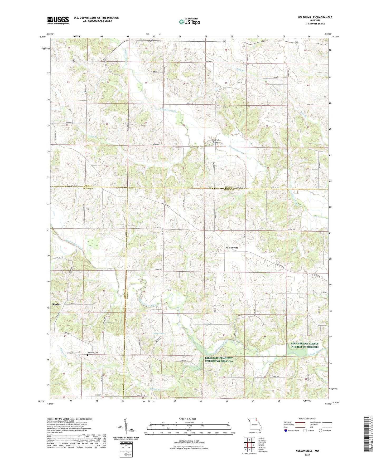
2021 topographic map quadrangle Nelsonville in the state of Missouri. Scale: 1:24000. Based on the newly updated USGS 7.5' US Topo map series, this map is in the following counties: Marion, Lewis, Shelby. The map contains contour data, water features, and other items you are used to seeing on USGS maps, but also has updated roads and other features. This is the next generation of topographic maps. Printed on high-quality waterproof paper with UV fade-resistant inks.
Quads adjacent to this one:
West: Newark
Northwest: La Belle
North: Lewistown
Northeast: Monticello
East: Durham
Southeast: Philadelphia
South: Emden
Southwest: Burksville
Contains the following named places: Allen Branch, Argola, Asbury Chapel, Bethany Church, Bragg School, Bridgman Dam, Brower Branch, Center School, Cherry Dell, Concord Church, Dickson Lake Dam, Doctor Wells Lake, Doscher Brothers Dam, Doscher Brothers Lake, Haycraft Bridge, Haycraft School, Iron Bridge School, Loscher Lake, Loscher Lake Dam, Methodist Cemetery, Mount Olivet Church, Mount Pleasant Church, Nelsonville, New Providence Church, Oak Grove School, Sigsbee, Sparrow Lake Dam, Tallent Lake, Tallent Lake Dam, Township of Salem, ZIP Code: 63440