MyTopo
Philadelphia Missouri US Topo Map
Couldn't load pickup availability
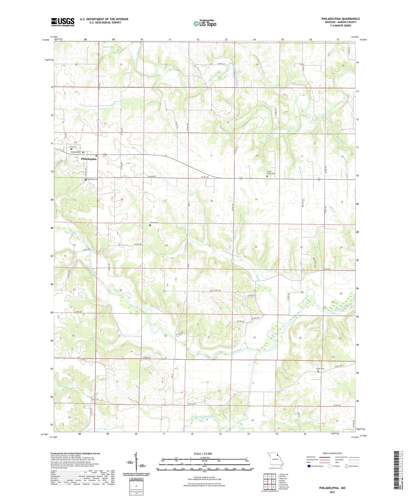
2021 topographic map quadrangle Philadelphia in the state of Missouri. Scale: 1:24000. Based on the newly updated USGS 7.5' US Topo map series, this map is in the following counties: Marion. The map contains contour data, water features, and other items you are used to seeing on USGS maps, but also has updated roads and other features. This is the next generation of topographic maps. Printed on high-quality waterproof paper with UV fade-resistant inks.
Quads adjacent to this one:
West: Emden
Northwest: Nelsonville
North: Durham
Northeast: Maywood
East: Palmyra
Southeast: Rensselaer
South: Monroe City
Southwest: Hunnewell
This map covers the same area as the classic USGS quad with code o39091g6.
Contains the following named places: Bevill Airport, Big Branch, Camp Inlow, Coleman Cemetery, Crane Cemetery, Doctor J W Well Dam, Doctor J W Well Lake, Four Corners School, Keller Branch, Kempf School, Little Union, Little Union Cemetery, Little Union Church, Little Union School, Marion County R11 Fire Department, Newmarket, Newmarket Branch, Oak Ridge School, Pea Ridge Church, Philadelphia, Philadelphia Cemetery, Philadelphia Census Designated Place, Philadelphia Post Office, Pigeon Creek, Prairie School, Russel Sandifer Dam, Saint Paul School, Sandifer Lake, Schmidt School, Sees Creek, South Fork North River, Terrill Cemetery, Township of Union, Vickrey School, White Franklin School