MyTopo
Durham Missouri US Topo Map
Couldn't load pickup availability
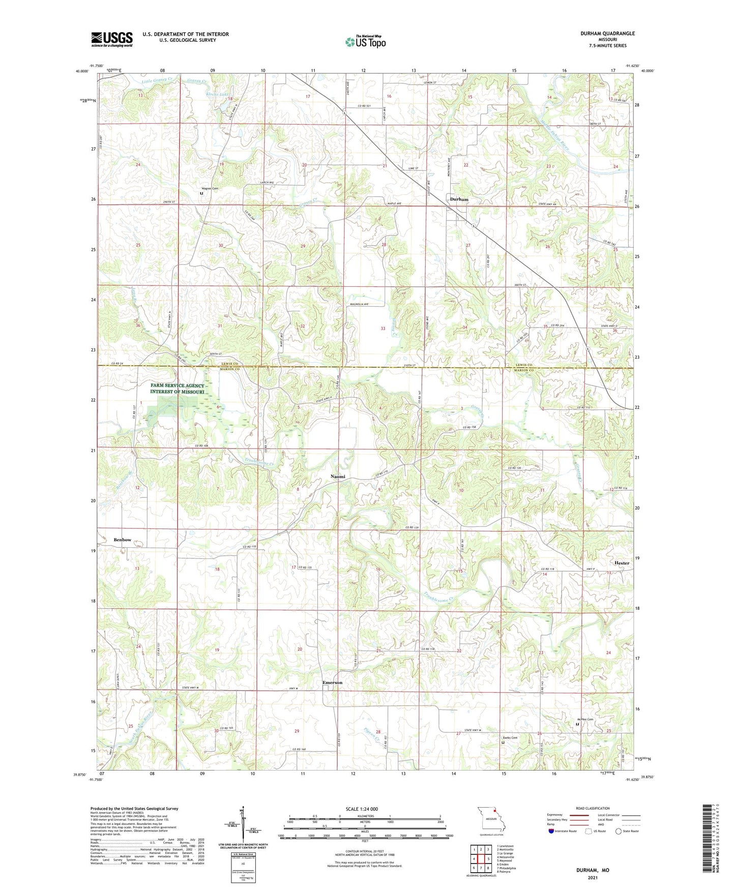
2021 topographic map quadrangle Durham in the state of Missouri. Scale: 1:24000. Based on the newly updated USGS 7.5' US Topo map series, this map is in the following counties: Marion, Lewis. The map contains contour data, water features, and other items you are used to seeing on USGS maps, but also has updated roads and other features. This is the next generation of topographic maps. Printed on high-quality waterproof paper with UV fade-resistant inks.
Quads adjacent to this one:
West: Nelsonville
Northwest: Lewistown
North: Monticello
Northeast: La Grange
East: Maywood
Southeast: Palmyra
South: Philadelphia
Southwest: Emden
This map covers the same area as the classic USGS quad with code o39091h6.
Contains the following named places: Banks Cemetery, Bell Echo School, Benbow, Bentbow Branch, Durham, Durham Fire Department, E F Speckhart Dam, Emerson, Gullion School, Hester, Klocke Lake, Klocke Lake Dam, Little Grassy Creek, Long Branch, McPike Cemetery, Mount Sinai Church, Naomi, Oakdell School, Speckhart Lake, Staggs Airport, Sutter Dam, Township of Highland, Township of Round Grove, Tucker's Mill, Wagner Cemetery, ZIP Codes: 63438, 63454