MyTopo
Newark Missouri US Topo Map
Couldn't load pickup availability
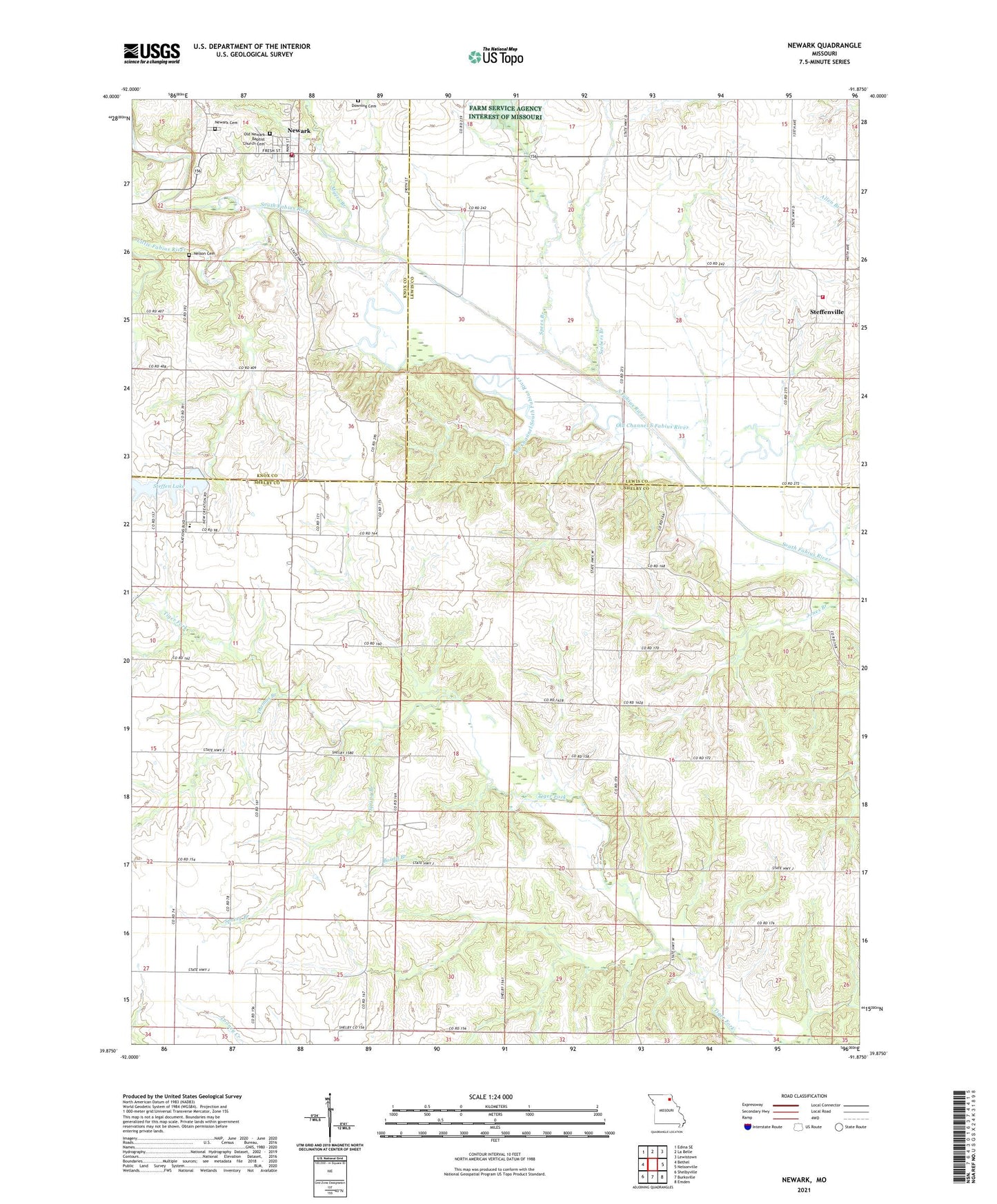
2021 topographic map quadrangle Newark in the state of Missouri. Scale: 1:24000. Based on the newly updated USGS 7.5' US Topo map series, this map is in the following counties: Shelby, Lewis, Knox. The map contains contour data, water features, and other items you are used to seeing on USGS maps, but also has updated roads and other features. This is the next generation of topographic maps. Printed on high-quality waterproof paper with UV fade-resistant inks.
Quads adjacent to this one:
West: Bethel
Northwest: Edina SE
North: La Belle
Northeast: Lewistown
East: Nelsonville
Southeast: Emden
South: Burksville
Southwest: Shelbyville
This map covers the same area as the classic USGS quad with code o39091h8.
Contains the following named places: Bethel Chapel, Board Branch, Downing Cemetery, Elgin, Elgin School, Garrison Church, Haman School, Jones Branch, La Belle Fire Protection District Steffenville, Little Fabius River, Myers Branch, Nelson Cemetery, Nelson School, Newark, Newark Cemetery, Newark Post Office, Newark Rural Fire Department, Old Channel South Fabius River, Old Newark Baptist Church Cemetery, Seebers Branch, Shilo Church, Shiloh School, Spees Branch, Spring Branch, Steffen Lake, Steffen Lake Dam, Steffenville, Thomas Branch, Township of Tiger Fork, Village of Newark, Whitelock School, ZIP Code: 63434